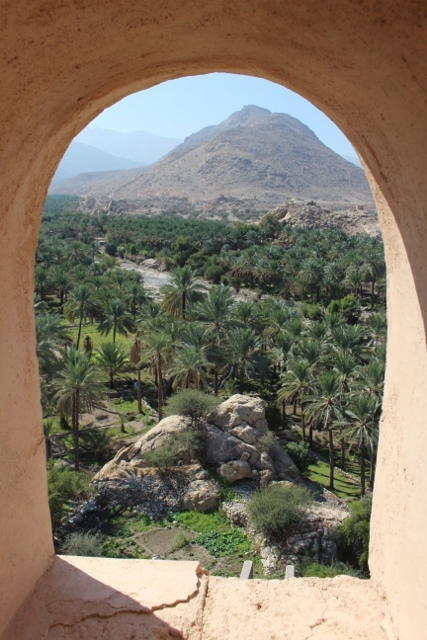
view from the Nakhl Fort over date plantations and wadi
A trip to Wadi Behi Kharous and Wadi Beni Awf, with a stop at the impressive, but heavily restored Nakhl Fort on the way
A popular outing from Muscat is a day trip to the wadis west of the city. A wadi is a river bed in arid areas, which means that for most of the year it is dry, and thus easily accessible. Make no mistake, though: if it rains, or if it rains upstream, the wadis are subject to violent flash floods, exactly those moments you don’t want to be trapped there.
There are several wadis coming down from the Western Hajar Mountains, the nearest to Muscat being Wadi Beni Kharous and Wadi Beni Auf. On the way, there is Nakhl, a small town with a big fort. We are certainly not going to see all forts in Oman – there is an estimated more than a 1000 fortified structures in the country -, but the Nakhl Fort, apparently, is one of the best.

Nakhl Fort
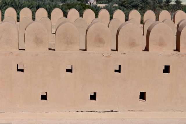
crannulations at the fort
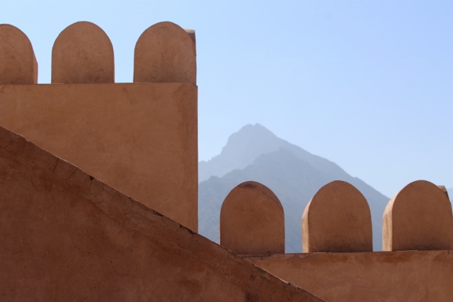
and more defences, same fort
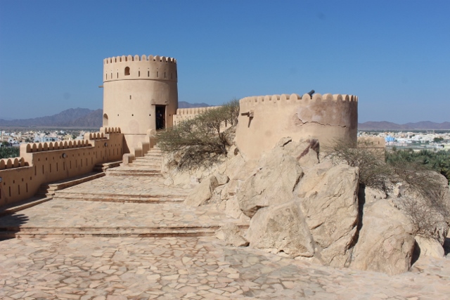
two of the towers of Nakhl Fort
The 350-year old fort, probably built on pre-Islamic foundations, is heavily restored in the 1990, but as much as possible with traditional materials – still, it is difficult to get a sense of authenticity here, it is just too nice, too perfect, too much of a museum. It does give a good overview of what these forts, or fortified houses, looked like. The fort is built on a rocky outcrop, which determines the lay-out, and was added to over the years. From a simple tower it evolved during the 17th Century into a structure with no less than six towers and a series of enclosure, housing several well ventilated rooms. Access to the towers is via a vertical ladder against one of the walls, a great entertainment for visiting children (and some adults, like me).

date palm plantations around Nakhl
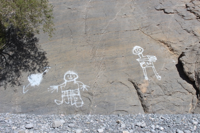
recent “rock paintings” in Wadi Beni Kharous
From Nakhl it is a short drive to the entrance of Wadi Bani Kharous, once again protected by a small fort. Apparently, another feature at the wadi’s entrance are ancient rock engravings, a subject dear to me. But trying to find them proved difficult; it being Friday, most people who could have pointed us in the right direction were in the mosque, and those who weren’t didn’t speak a lot of English. In a small village, just off the road, they do seem to understand what we mean, but then send us to some recent graffiti on the limestone outcrops, which has little to do with what we are looking for. They also insist that we come inside, and with traditional Middle Eastern hospitality force a fabulous lunch upon us, with fruit and dates, and deliciously grilled fish.

the wadi floor, and the steep flanks in the distance
The wadi itself is a wide valley, deeply eroded into the mountains. All around us, sheer vertical walls, and very little vegetation. Yet, there is water underneath, and every couple of hundred meters, or so, wells have been dug in the wadi. And further on several terraces are actively being irrigated, providing ample space for lots of date palms, but also other crops. The irrigation here must come from the falaj system, an age-old network of water channels that lead from springs in the mountains to the villages, everywhere in Northern Oman – and obviously, provide a life line for the people living here.
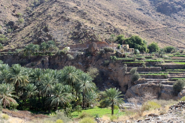
date palms and agricultural terraces

more terraces, and the irrigation system, the falaj, in the back

entrance to Wadi Bani Awf

even more colourful in flight
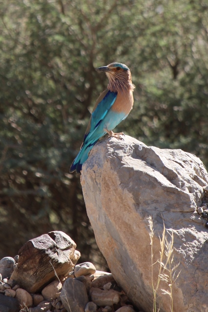
a bird in the wadi
What we didn’t know at the time – poor preparation -, is that there exists a link with Wadi Bani Awf, across the flanks of the mountains. In the event, we drove all the way back, and then to the entrance of this wadi, which is equally spectacular with its rugged, barren landscape. Fairly soon, we ran out of tarmac, and continued on an unsurfaced road. Time prevented us from reaching the end of the wadi, or the beginning, whichever way you look at it, from where a steep (4WD only) track leads up the Hajar Mountains, to the village of Al Hamra and on to Jebel Shams. Equally, we never reached Snake Canyon, a steep gorge almost at the end; but we did get to what is called Little Snake Canyon, an equally steep, but smaller gorge.

this is, in any case, pretty obvious

goats keep their balance on the steep slopes
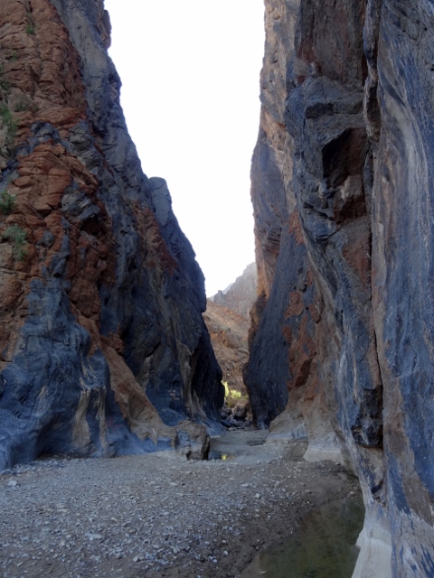
Little Snake Canyon

with a bit of water left, after rains
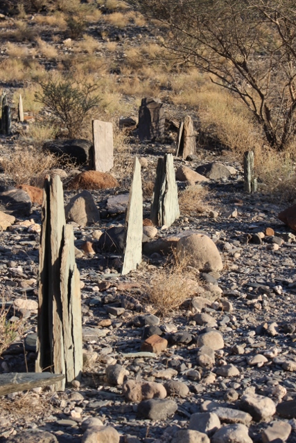
Another aspect of the wadis are the cemeteries, of which we found several. The valley floor must be far too hard to bury anybody here, but in certain places stones representing graves had been erected, roughly arranged in rows, and firmly placed in the ground. I am not sure how this works, exactly, but it’s a peculiar feature, these stones.
next, to Nizwa
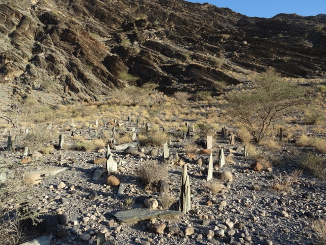
one of the mysterious cemeteries
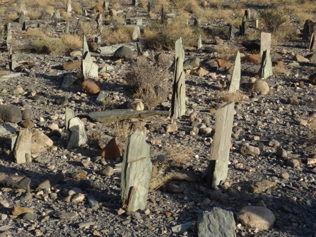
stones firmly planted in the hard valley floor
more stones, arranged in rows


