Roman theatre in Bosra, one of the most brilliant Roman sites in Syria

My guidebook, from 2010, calls Bosra the second-best preserved Roman city, after Palmyra. ISIS has seen to it that it is now the best preserved Roman city. With as absolute highlight its Roman theatre.

It is about two hours’ drive from Damascus, and we break the trip at a sweets factory, to see the production process – a conveyor belt, but then with people carrying out the individual different steps in the process. As part of the visit we taste the various sweets, as well. And they are good! This particular company, according to our guides the best in Syria, exports all over the world; in order to circumvent sanctions, they have a second outfit in Jordan – which is not subject to sanctions. It is that easy! I buy a large box, to see if I manage to take it out of Syria and into Europe without being caught sanctions busting.

part of the human conveyor belt

manually cutting the individual rools of sweets

this one, too – impossible not to pinch a piece!

a box of sweets like the one I bought, in the shop of the sweets factory

cost of the box some 25 US$, in local currency 400,000 Syrian pounds; paying is a challenge, with largest bills no more than 5000 pounds (photy Constanza Fernandez/experiencingtheglobe.com)

To get to Bosra, we actually need to transfer to rebel territory, this corner of Syria is held by the Free Syrian Army. Obviously the rebels have come to some agreement with the government. We pass another check point, to me no different from the others, but this one manned by rebels – if you can still call them so. The only difference? The portraits of Bashir have disappeared.

apparently perfectly normal here: sheep in large flocks on the motorway

effortlessly moving against the traffic!

the agricultural motorized fleet is rather dated

but still in full use, also for other than agricultural activities – like moving house, perhaps?

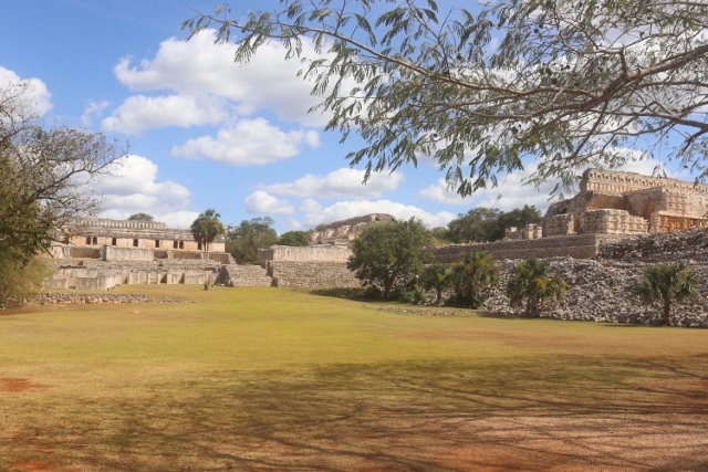
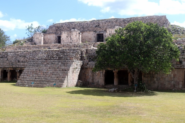
the Roman city of Bosra, built from basalt

bits and pieces have been restored, it looks

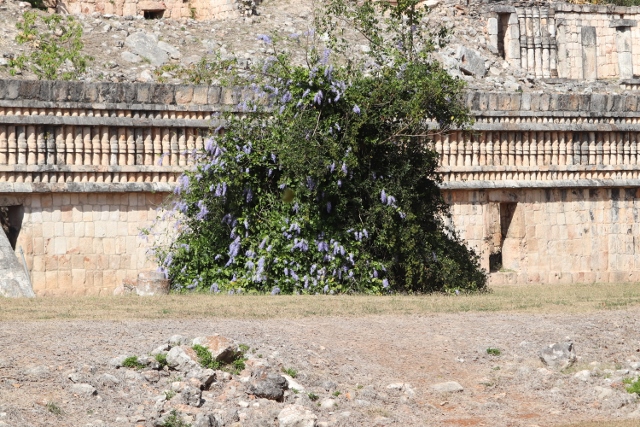
carpets for sale at Bosra – sadly, the people here have seen their business dry up almost completely, as a result of the civil war

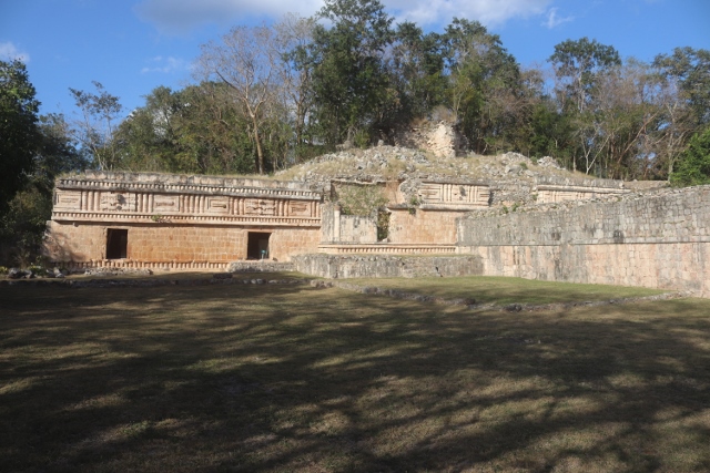
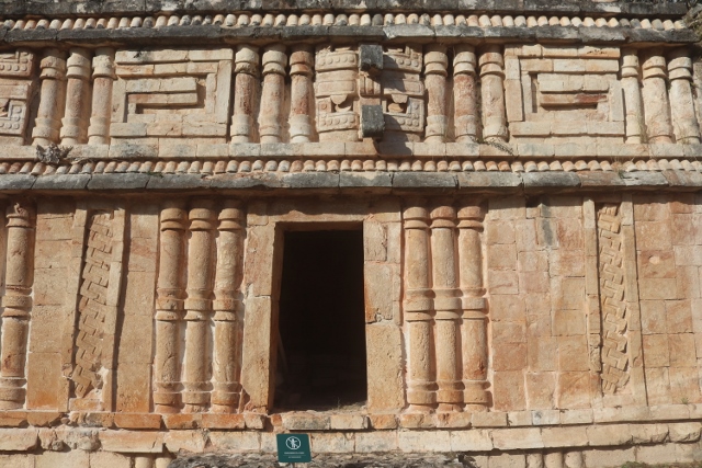
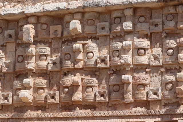
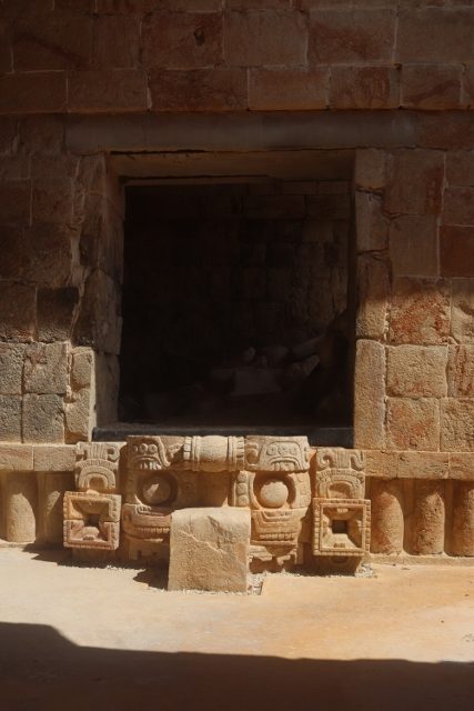
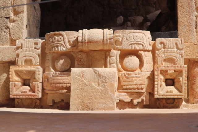
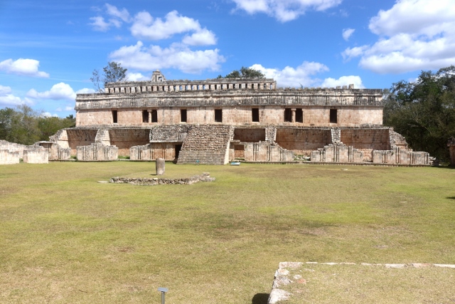
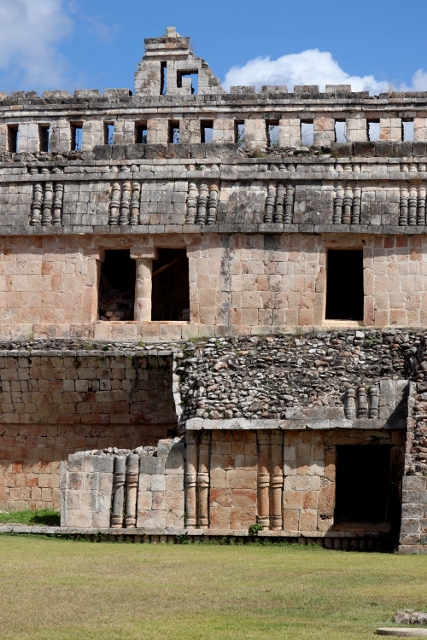
Bosra featured in old – 14th C BC – Egyptian archives, was held by one of Alexander’s generals, and then became an important town for the Nabateans, those of Petra-fame in Jordan. The Nabateans were subsequently conquered by the Romans in 106 AD, after which emperor Trajan made Bosra the capital of its Province Arabia. The resulting Roman town, largely built from black basalt found on the plains around here, is an impressive collections of buildings. A colonnaded main street runs between several hammams – bath houses. To one side is a monumental arch that provided access to the town, on the other side is the large cathedral and the basilica, as well as several mosques which probably have been churches before. Their minarets look remarkably like church bell towers. At the side of the cathedral we decipher frescos which, according to our guide, date from the 6th Century – and why not, after this date the Muslims reigned, forbidding this type of decoration.

one of the large cathedrals, or what is left

with very old – 6th C – frescos on one of the walls

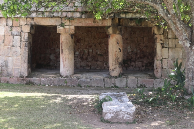
another church, no doubt

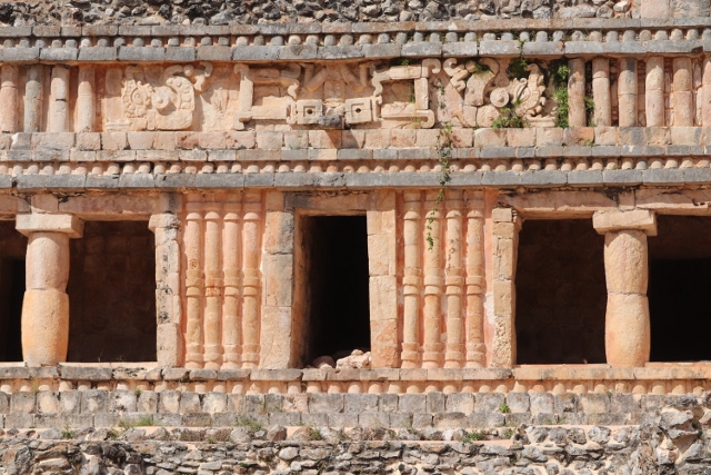
built from basalt, including the pillars

impressive interior of another ancient church

and, as in every Roman town, columns

columns as far as the eye can see!

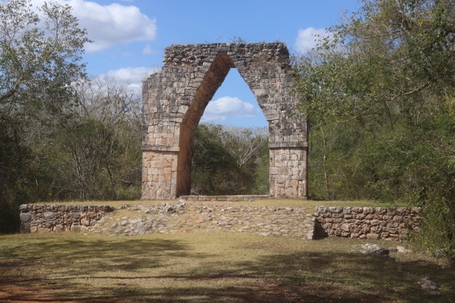
tje arch at the entrance of the city – one of the arches, to be precise

But the absolute highlight is the black-basalt Ayyubid fort, attractive in itself, but especially interesting because it has been built around the large Roman theatre inside. It is because of the fort that the theatre is so well preserved. Initially, as part of the fort it was maintained. Later, when the fort fell in disuse, sand blew into the theatre which protected it further, not only from the elements, but especially from people wanting to use the stones for their own buildings. The approach is spectacular: you wander through the fort, in between high walls, to ultimately emerge at the top, with your sudden, brilliant view over the entire theatre, in an almost perfect state. A fabulous sight!

next: Ma’loula

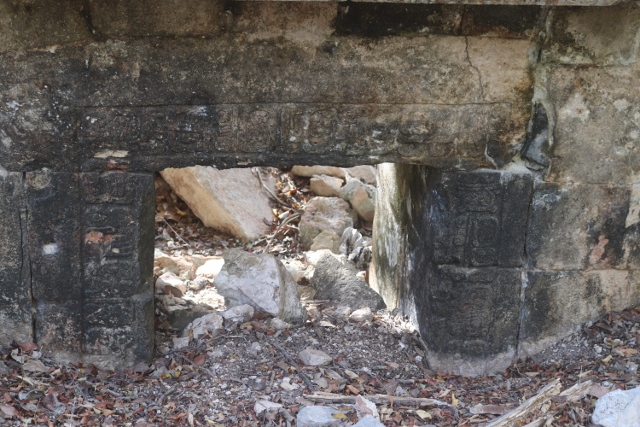
these are the vaults of the Arab fort that has been built around the Roman theatre

through which you walk, to get to the uppar ranges of the theatre itself

which then provides you with a most splendid view of the stage, the building and the theatre seats around

the building is almost perfectly intact, undameged over the years – note the seats in front

another row of honourary seats, with even the backrests still standing

the stairs up and down the seating area

lots of decorated columns at the stage

view from the top of the Arab castle, over the city of Bosra

and the same in a bit more detail

and even further detail

the damaged church in Al Quneitra, with another collapsed building in front

The main target today is Al Quneitra, the main town on the Syrian side of the Golan Heights. But first we drive all the way to the end, to the village of Ain Altinah – the end of the Syrian part of the Golan Heights; that is, the Israeli-administered part is across from a 200 meter wide, apparently heavily mined zone, bordered by some major fences. This situation is the result of the various wars between Syria and Israel, in 1967, when Israel occupied a very large part of the Golan Heights, and 1974, after which Israel withdraw from a portion of its occupied area and Syria got part of it back. We can see the other side  Majdal Shams, see the people walking there, it is really close. And really weird. Weirdest, though, is that we observe this from a purpose-built platform, I suppose where people come – local tourists – to look at the other side. Whilst, in all honesty, there isn’t a lot to see. Indeed, there is nobody else but us; our guide claims that we are the first foreign group to reach here in many years, as the place is usually out of bounds for foreigners.


watch tower, unmanned at the moment, along the de-facto border

the lively Israeli town, Majdal Shams, across the border

the double fence at the end of a mine field, that forms the border zone

the purpose-built viewing platform from which to look at waht was once Syrian territory

there is is, from inside the platform: Majdal Shams, the occupied part of Syria

everywhere in Al Quneitra are the remnants of destroyed buildings, allegedly by Israeli forces between 1967 and 1974

the church door

and the inside of the church, little left

another collapsed building, earthquake-like

To show the world how savage Israel went about its business, the Syrian government has kept a large part of Al Quneitra, the town occupied by Israel and later vacated, unchanged, that is to say, all the war damage to houses, to a museum, to a church, is still as they found it when they returned after the 1974 agreement. And it is, indeed, impressive; it reminds me of Haiti after the earthquake of 2010, with lots of concrete slabs of houses collapsed. At the same time you wonder why it is so difficult to get a permit to visit this part of the country, if it is just to show what the enemy once did. Anyhow, I don’t know; perhaps this is also a kind of Gaza avant-la-letre. And in any case, I am pretty sure that in quite a lot of Syria nowadays there is equally, or worse, evidence, of the savagery of the Syrian government upon its own people.

next: the Roman theatre in Bosra.

we have lunch in a resort at an artificial lake in the Golan Heights, where sheep form the only other entertainment

the Golan Hights are divided between Syria and Israel, with a UN force trying to keep the two apart

The short history of the Golan Heights – and I am sure there are many different versions – is that Syria attacked Israel in 1967, using the Golan Heights as its launch pad. After which Israel hit back, invaded Syria instead, and occupied the Golan Heights. In 1973, during the following war, Syria recovered part of the Golan Heights, but was subsequently pushed back once again by Israeli forces. A cease fire line and a de-facto border was agreed in 1974, leaving 2/3rd of the Golan Heights Israel-controlled, and the eastern 1/3rd administered by Syria.

The disputed division of the Golan Heights between Israel and Syria

Administered? There is not much to administer, from what we see there are hardly any  villages, towns. Hardly any normal houses. Apparently it is very difficult to get a permit for visiting this zone. The military dominates here. As we have been instructed not to take pictures of anything military, under no circumstances, you have to make do with the description. In the hills man-made caves have been dug, well reinforced, which no doubt hide various types of artillery. Army positions are on the mountain ranges, but also all over the plateau. Lots of bunkers, largely made of the basalt blocks that litter the plains and finished with oil drums, painted in the Syrian colours. Often there are three or four of them together, at road junctions, which are invariably also covered by check points. And more check points, I don’t know how many we pass in just one day. We see military vehicles, armoured personnel carriers, the occasional piece of artillery, a machine gun position covering the road – a favourite place is on the viaducts over the main road. At one place a rough fort seems to have been built, basalt block walls with a low tower every 20-30 meters, or so. Man-made trenches, maybe to deter tanks, cross the countryside. Everything oozes military. Even the boots outside a hut are army boots.

the only military facility I can photograph, a UNDOF camp in the distance

In reality, the army is forced to stay at least 25 km away from the de-facto border, the zone in between being controlled by UNDOF, the United Nations Disengagement Observer Force.

In a smart move we pick up a military escort at one of the first check points. The man is not in uniform, his car is – to us – unrecognisable as army vehicle, yet at every next check point we pass without hassle; our escort is immediately recognised, lots of back slapping between our friend and the soldiers. Describe a check point: on major roads, like those around Damascus, these are broad arches across the road, from corrugated iron; and in the run up concrete slabs have been placed, to separate road lanes. Incredulously, sometimes there is a fast lane for VIPs, and the good news is that foreign tourists fall in that category. On busier roads quite long lines of cars are waiting to have the papers checked, and often the boot of the vehicle, too. On smaller, quieter roads the concrete slabs are put perpendicular to the road, to slow down traffic. On the side of the road is often a bunker, the ones made of rocks and oil drums filled with sand, with armed soldiers. Oh, and everything is in the Syrian colours, of course, red, white and black with green stars: the concrete slabs, the oil drums, the corrugated iron, you name it. Except that it has been there for a while, so is pretty faded by now.

patches of snow on distant mountains separating Syria and Lebanon

Another feature of the check points, and of the countryside in general, is the ever-present portrait of the president, Bashar al-Assad. Often also pretty faded.

the Golan Heights are mostly basalt-block covered plains, at first sight not very productive

Then to Golan Heights, and they are high, over 1000 m. Even in the sun it is a bit chilly, from the breeze. The land here seems pretty dry, initially not much vegetation. Yet, this appears to be the region in Syria that receives most rain, traces of which we see as patches of snow on some distant mountains, the Anti-Lebanon range, I think. In some places there is agriculture, olive trees, and cherries. Later in the season they have a lot more fruit, here, figs, apricots, even apples. Hard to imagine, in this environment, but the cherries are real, and they taste good!

next, we have a look at Al Quneitra

local women active in the fields

there are actually people other than military in the Golan Heights, the ones producing the bulk of the fruits and vegetables for Syria

the border between Lebanon and Syria, with the image of president Bashar Assad

There are no flights to Syria, at least not from any airport near me. Most airlines fly to Beirut – which suited me well, because my Lebanese friend had just returned from Rafa, in Gaza. Yes, that one. After a relaxing day in Beirut the group departure was scheduled early morning from the city centre. And an hour-and-a-half later we arrived at the border. Leaving Lebanon was a piece of cake, entering Syria took somewhat longer, because of system changes and shift changes, but in the end we cruised through this part, too. Lots of people in uniform, but altogether not unfriendly, it is just that the steps in the process need to be followed, so first pay for your visa, then go to someone who checks that you have paid for your visa, then another control, another scribble, and finally the relieving stamp. At each and every step in the process somebody goes through each and every page of your passport, to make sure that there is no evidence of you ever having been to the Great Enemy, Israel. I have got quite a few pages filled up in my passport, so scrutinising it takes some time. Likewise, the other group members are also well travelled.

tented camps, for which I suppose are Syrian refugees, on the Lebanese side of the border

In the run up to the border the Lebanese side is fully built up, with towns and villages along the road, as well as lots of small scale tented camps, which, I suppose, house Syrian refugees. Then there is no-man’s land, and then the Syrian side, deserted, in stark contrast with Lebanon. It is only when we get closer to Damascus, which is only 45 kilometres from the border, that we start seeing buildings again. In fact, lots of them, the majority under construction, but unfinished – possibly started long ago, ran out of money from economic downturn following the war. The war, these days, is the civil war after the Arab Spring.

at the border we are welcomed by Bashar Assad, the first of many of his images

also at the border, plenty of vans packed to the hilt – with what could be legitimate imports, or sanction busting, who knows?

But our target for the day are the remnants of that other war, or rather, the two wars that Syria fought with Israel, in 1967 and again in 1973. Which collectively resulted in the present-day de-facto border between the two countries, which splits the Golan Heights.

this is a rather long piece of text, to put what I am going to see the next ten days in some context, but if you like – I know some of you are not really interested – you can skip this, and go straight to the start of the actual trip.

There is a reason, of course, that everybody is so negative about traveling to Syria, and that is to do with its recent history. More about that later.

The earliest history of Syria is pretty well known, I suppose. Bordering Mesopotamia, the cradle of our civilization, it has been inhabited for  tens of centuries, mostly under the influence of ancient empires, like Egypt and long forgotten powers like the Hittites and the Hurrians, as well as Assyria – not to be confused with present-day Syria, which is an entirely different, unrelated entity. In fact, in the 9th and 8th centuries BC the Assyrians became the prime enemy of the Arameans, a collection of Semitic tribes that had gradually moved into what is now most of Syria, with their principle kingdom established in Damascus. Assyrian domination fell to Babylonian domination which fell to Persian domination – we are talking 539 BC now.

Roman theatre in Bosra, one of the most important Roamn cities in its Syria province

Krac des Chevaliers, the largest Crusader castle in the Middle East, and inside Syria

Another 200 years later it was Alexander the Great, who established Greek rule, which was short-lived because of his early death and internal strife. It took the Roman general Pompey to conquer the whole area in 64 BC, and establish the Roman province of Syria. Rome’s collapse created space for Byzantine Syria, administered from Constantinople, before the Islamic conquest in the 7th Century AD – Damascus surrendered in 635 – created a new, Muslim overlord, the Umayyads dynasty. Who were in turn overthrown by Abbasid Caliphate, which also disintegrated, after which the Syrian territory was once again split up between foreign powers. The Seljuk Turks briefly came, and went again, then Saladin reunited the Syrian territory and annexed Egypt, and established the

Ayyubids dynasty, which was in turn overthrown by the Mamluks from Egypt. Things were not made easier by constant fighting with the Crusaders, who held territory along the coast, and by the Mongol sacking of Aleppo in 1260. Yet, the Mamluks held on to the 16th C, after which the Ottoman gradually increased its power over Asia Minor, including Syria. And held on to that for the next 400 years.

Modern Syria

the Sykes-Picot agreement of 1916, and the current borders in the Middle East (source: The Economist)

The First World War sees the defeat of the Ottomans, and the carve up of the Middle East by France and Brittain, through the infamous Sykes-Picot Agreement of 1916. The newly created state of Syria, with the territories of Lebanon, Palestine and Transjordan stripped from it, becomes a French mandate. Syrian independence, declared in March 1920, was short-lived and ended four months later with the Battle of Maysalun, near Damascus, where the French comprehensively beat the Syrian independence forces.

So much for the early history, in which Syria was never a united, single entity for any prolonged period of time. The current borders, pretty artificial, have been in place for a little over one hundred years, and since 1946, when Syria was granted its independence, define the country.

Well, ‘define the country’ up to a certain extent. Firstly, Syria and Egypt jointly agreed on forming the United Arab Republic, in 1958. But dissatisfaction with Egyptian dominance of the new state led to its dissolution again, after a military coup in Syria in 1961. The restored territorial integrity of Syria was then compromised by Israel, which captured a significant part of the Golan Heights after the 1967 and 1973 wars, an occupation that continues until today. We are going to see some of that on this trip, I believe.

often forgotten, Assad-pere, Hafez Assad, strated his career as an ordinairy coup ploter, of course (source: Wikimedia)

Politically, the independent country witnessed military coup after coup, after a brief democratic start. Then Hafez al-Assad, leading the military wing of the Ba’ath Party, grabbed power in 1970, and turned out to be the only coup plotter who had staying power, based on popularity amongst adherents to his anti-Israel policies and on harsh suppression of opponents – like the Muslim Brotherhood, which was savagely crushed in the city of Hama in 1982. Syria became, for the first time perhaps, a relatively stable country. Which is remarkable, given the many tensions and issues that play in the country, and in the wider Middle East: no Syrian history without the idea of Pan Arab unity, or the relationship with Lebanon and its civil war of the 1990s (or the assassination of its president Hariri in 2005), and what about the Kurdish minority, its links with the Turkish PKK, and thus tensions with neighbour Turkey, oh, and the rivalry with Iraq and its own Ba’ath party, and Iraq’s war with Iran, in which Syria supported Iran. And what about Sunni-Shiite rivalry, in which the Alawites – the Shiite breakaway group to which the Assad family belongs, as well as all of their trusted advisers surrounding the president – needed a fatwah from Ayatollah Khomeini to declare them true Muslims, because the presidency of Syria can only be fulfilled by a Muslim.

The 21st century

Yet, in the more recent past that stability proved elusive. In 2000 Assad-pere was succeeded by Assad-fils, Bashar al-Assad, which initially looked to be a good thing, promising change and modernisation. However, when the Arab Spring also sparked protests in Syria, the government responded with its tested and trusted approach, use of excessive violence to break up demonstrations. But this time the opposition formed its own militias and fought back, leading to a full blown civil war which took years. Initial international efforts, by the Arab League and later by the UN Security Council, to broker a cease fire came to nought, and individual governments started to support rebel groups (eg Turkey, Qatar and Saudi Arabia) or the Syrian government (Russia, Iran). But international military intervention never materialised, not even after the use of chemical weapons in 2013, despite calls from several corners. Direct support in the form of weapons and ammunition to rebel groups was also unpopular with western powers, because the opposition groups were far from united, and contained several Islamic factions, as well.

how we all recognise ISIS fighters from our news sources

And indeed, from the power vacuum in neighbouring Iraq the Al-Qaeda Islamic militants morphed into ISIL, for us better known as ISIS (Islamic State in Iraq and Syria), and even though the Syrian Al-Qaeda-affiliated Nusrah Front – indeed then part of the collective anti-Assad opposition – distanced itself from ISIS, the group made rapid inroads into Syria, as well. With significant territory under control in Iraq and Syria it established its Islamic Caliphate in 2014. This then finally triggered international military response. The US launched air strikes in Iraq against ISIS later that year, and also materially supported Syrian Kurds in their fight against the Caliphate. In 2015 the Russians also got involved, allegedly to fight ISIS, but in the process also propping up Syrian government forces against the opposition militias – just in time, as Bashar al-Assad was then losing the battle. With Russian support, especially air strikes, the opposition was driven from Homs, Syria’s third largest city, late in 2015, and from Aleppo in 2016.

maximum extent of ISIS-held territory in Syria

The attention then turned to ISIS, which held out to end 2017, but was – at least as territory is concerned – finally defeated from various sides, by a combination of Syrian Kurdish forces supported by the US, by the Nusrah Front, and by Assads troops, Russia-supported. Despite this common goal, several western countries bombed targets near Damascus and Homs in 2017, after further use of chemical weapons, and Israel bombed lots of Iranian military facilities in Syria in 2018.

the situation with rebel-held territory at present, more or less


Also in 2018, Syria, with Russian diplomatic support, began to retake areas held by opposition forces in the south-west of the country, by promising the fighters free passage to Idlib, the only area still firmly in the hands of the opposition – and protected by Turkey, who aimed for a buffer zone to avoid direct confrontation with the Syrian army. However, the Nusrah Front successor, HTS, i.e. another Islamic militant group, had become the dominant force in Idlib, which triggered another Syrian offensive in 2019, ultimately followed by another cease fire, brokered once again by Russia – Syrian and Turkey friend – in 2020. And since then it has been relatively calm at the battlefield in Syria. Well, except that Israel is still occasionally firing rockets at targets in Syria, but that is par for the course, I would say.

Of course, this piece of text is kind of the shortest possible summary of what is available on internet, and it is no doubt incomplete, in part incorrect, and a vast simplification in the first place. It comes from sources I personally trust – but are, and I realise this, also part of my, my Western, bubble (for instance, https://www.britannica.com/place/Syria/Media-and-publishing#ref214617). In the next few days, traveling through Syria, I do get quite a few alternative versions of Syrian recent history, which I will try to incorporate as much as I can, as impartially as I can.

next: the trip starts at the border.

The idea to travel to Syria hatched at the end of November 2023, at a time that the conflict in Gaza was still pretty much geographically ‘contained’, if I can use that word. But in the following months the situation became increasingly complex, with Israel attacking the Iranian diplomatic mission in Damascus, Iran firing rockets at Israel and Israel contemplating retaliation, whilst Hezbollah was sort of low-key contributing with its rockets fired from Lebanon, seemingly trying to provoke another Israeli response. Hmm, our trip will start in Beirut, Damascus is obviously on the itinerary, too. I did wait rather a long time with booking my ticket. But then I did, once the situation seemed to calm down somewhat.

In the meantime my phone is almost permanently overheating. By now we are three groups – traveling back-to-back, not all at the same time -, some 35-40 people in total, and everybody is included in the same WhatsApp group. Part of the communication is quite useful, like suggestions on what to take along. Bring cash; actually, bring US$ only. And make sure they are crispy, new notes from after 2013, older is not being accepted locally. And also what NOT to bring along: one of the group seriously thought he could take his drones with him. Other group members are discussing side trips in Lebanon ahead of the Syria tour, and exchanged info on hotels, on SIM cards. In fact there were so many messages flying backwards and forth that some people couldn’t find back earlier answers to questions, so asked again. Dietary requirements, like “I don’t eat tomatoes”, and questions about dress code, “can I wear shorts?” and “what is better, running shoes or sandals?” Really. Well, part of group travel in the 21st century, I guess. Had I not vowed never to go group travel again, after my last – and first – experience? And we haven’t even left yet!

but first, a bit of history; or skip it, and go directly to the border.

the Syrian flag, frayed

I do admit to a certain amount of opportunism. Years ago we planned to go to Syria, only to be denied by what was then euphemistically called the Arab Spring. We all know how that has developed in the past years, and especially in Syria. So when some organisation I know announced a trip to Syria, small group only, I jumped on the opportunity. And where some time ago, for our West African trip, my wife was ultimately the driving force in the decision to go, her reaction this time was less positive. ‘Lunatic’, she called me, and refused to even consider joining.

Not content with one opinion only, I consulted ChatGPT, that source of information succinctly summarising the views on the internet: is it a good idea to travel to Syria?’ The answer:

‘Traveling to Syria is not advisable for most people due to ongoing conflict, security risks, and unstable political conditions. The country has experienced significant turmoil, including civil war and the presence of extremist groups, which have led to widespread violence and destruction. Additionally, there may be travel restrictions, limited access to basic services, and a lack of consular support from many countries.

Before considering travel to Syria, it’s crucial to thoroughly research the current situation, consult travel advisories issued by your government or international organizations, and consider the potential risks carefully. It’s generally recommended to prioritize safety and avoid travel to areas with active conflicts or unstable conditions.’

You know, don’t blindly trust AI. I have more resources. A good friend of mine is Lebanese, has his house in Beirut, has recently worked in Syria; he will have a much more balanced view. And he will know whether it is safe or not. So I called him, asked ‘Johnny, where are you these days?’ And when he casually said ‘Gaza’ – we are talking right in the middle of the Israeli assault, here – I realised that he would be the last one to tell me things are not safe. And indeed, he didn’t think it such a crazy idea to go to Syria.

what do I expect from Syria? Roman ruins….

and more recent ruins, of an entirely different nature

In any case, by then I had already signed up for the trip, paid an advance, and dug into the details of the journey. We are, the twelve of us, traveling from Beirut to Damascus, and then with a trusted local guide first to the Syrian side of the Golan Heights, and then  to various places further north, ending up in Aleppo. On the way back a long day’s travel to Palmyra and on to Damascus, before returning to Beirut. Chance in a lifetime to see a bit of Syria – I don’t think I would travel on my own, without local support. And chance of a lifetime to experience local culture, from visiting Bedouins to attending a cooking class in traditional Syrian fare and – get this – participating in local wine making! In between the mosques, crusader castles, souqs and UNESCO World Heritage Site Roman theatres, of course. In and out in ten days. What could possibly go wrong?

next: the preparations

itinerary for a ten day Syria trip (Al Mistaya is Krac des Chevaliers, Tadmur is Palmyra)


decoration along the edge of the Grand Palace in Labna, depicting a head in a snake’s mouth

Labna is one of the smaller Ruta Puuc sites of Mayan origin. Most of the site’s buildings are from the Late Classic period, 600-900 AD, like the other UNESCO World Heritage sites here, Uxmal, Kabah and Sayil.

the plan of the Labna site, very compact

The main structure, the Grand Palace, is with its over 120 meters width even larger than similar the palaces at Kabah and Sayil. It is two-storey high, and richly decorated with geometrical forms, and with Chaac masks, depicting the dominant god at the time.

A short sacbe, a raised Maya road, leads to the nearby look-out, much better preserved than the one at Sayil, and to an arch, which used to be the entrance to the city. Several smaller buildings around the arch are equally nicely decorated. Worthwhile a visit, even a quick one, as all the best buildings are within easy walking distance. Further infor is on https://www.themayanruinswebsite.com/labna.html.

Below I have included a few more of my photos.

part of the Grand Palace of Labna

part of the Palace’ facade, and entry to one of the rooms

geometric decorations and the half-pillars

typical Ruta Puuc decorations of the Palace

geometric decorations above each of the two storey of the Palace

Chaac masks, also part of the Palace decoration

another decoration, probably part of a statue of a warrior

the low buildings next to the arch, with the look-out in the back

one of the Maya stelea on the Sayil site in the Ruta Puuc area

Sayil, the Maya site located along the Ruta Puuc, covers a much bigger area than the other three sites visited during our Yucatan trip of 2024, Uxmal, Kabah and Labna. Like the others, it is also Late Classic, 600-900 AD.

It contains one spectacular building, the Grand Palace. It is more than 70 meters wide, with three storeys and a monumental staircase leading to the top floor. The structure is decorated, although less so than other structures in the Ruta Puuc area, and is surrounded by half-columns, as part of the decoration.

the plan of the Sayil site, with the Grand Palace at the bottom, and a long sacbe – road – leading all the way up to the South Palace

From here, a sacbe, an old Maya road, leads further onto the site, past lesser buildings, several stelea, a look-out tower, to the Southern Palace, which is a lot less restored, and much less impressive. Another path leads to the Temple of the Hieroglyphical Jambs, of which we only found very few, indeed, on a doorway. Altogether, if you stick to the Grand Palace, Sayil is an impressive place. Having said so, wandering the rest of the side is good for the Indiana Jones feeling! More here: https://www.themayanruinswebsite.com/sayil.html.

Below are some of my photos.

the Grand Palace of Sayil, three storeys high, monumental stairs, and pillar decoration all around

the half-pillars

and some real pillars, and decoration work

a bit of colour from the plants

What used to be the sacbe, the Maya road, leading from one end to the other in Sayil

the look-out, halfway up the sacbe

the South Palace, smaller, and not as well preserved and/or restored – but with the same half-pillars

another view of the South Palace

the House of the Hieroglyphical Jambs, with right the best visible doorway

and indeed, there are some hieroglyphs on the jambs, the doorway-sides

part of the profusely decorated Palace of the Masks at the Mayan site Kabah

Kabah is the second largest Mayan site along the Ruta Puuc in western Yucatan, after Uxmal. Like Uxmal, the architecture here also dates from the Late Classical period, 600-900 AD.

the plan of the Kabah site, with the most important buildings in the eastern part

The most impressive structure is the Codz Pop, or Palace of the Masks, a 55 meter long building of which the façade has been decorated with some 260 masks of Chaac, the rain god and one of the dominating religious characters at the time. There are several chambers inside, and a temple like structure on the top. At the back of the Palace are two more-than-life size sculptures, most likely a later addition with hallmarks of Tolmec culture.

the Kabah site, with to the right the Codz Pop, and to the left the main Palace

the facade of the Codz Pop building, also called Palace of the Masks

hieroglyphs decorate an altar in front of the Codz Pop, the Palace of the Masks

and these are some of the masks, all the same, of the god Chaac

and even the door steps to individual rooms have a mask

here is much more detail

the temple-like structure is in fact an open roof comb, adding height to the building

the back of the Codz Pop – poor light, I am sorry – with the two large sculptures

one of the two large sculptures at the back of the Codz Pop

Next, and a little to the back of the Codz Pop, is a building complex, of which the Palace is the most important, flanked by the building Teocali on one side and the House of the Royal Insignia on the other. The perfectly symmetrical, two-storey Palace, with sixteen rooms on each floor, shows similarities to the Palace in nearby Sayil and the one on Labna.

the Teocali, one of the buildings flanking the main Palace

and a small room inside the Teocala

the main Palace, symetrical, two-storey, also adorned with a open roof comb

close-up of the main Palace facade

part of the House of the Royal Insignia, on the side of the courtyard in front of the Palace

another view of the Palace, from a distance – when the sun finally started shining

the largely restored Arch, the original access point to the city

On the other side of the main road is the Arch, originally providing access to the site. Therre are also further buildings, like a pyramid, for which we unfortunately had no time left to explore. A good, more detailed description of the site, including old photographs is on https://www.themayanruinswebsite.com/kabah.html.

My pictures hereunder are just some examples of what one can expect, with mostly less than favourable light.