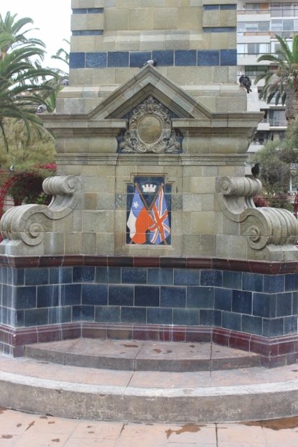
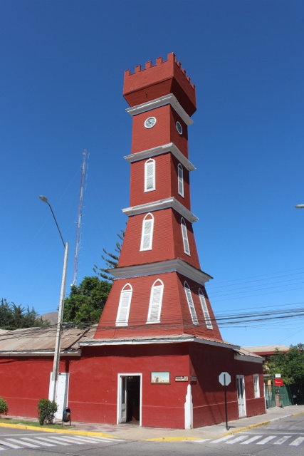
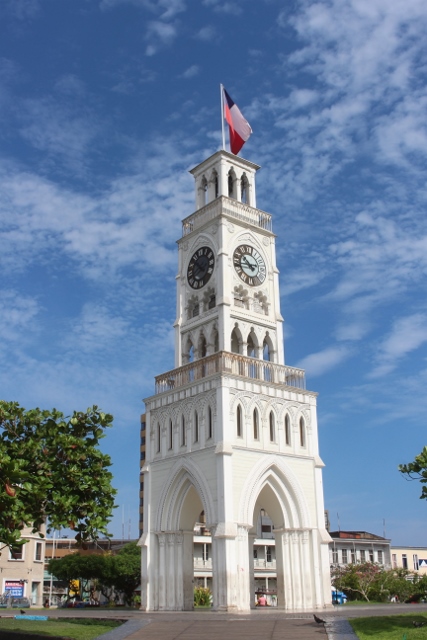
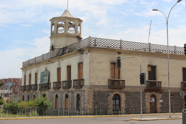
the clock tower in the centre of Iquique

Pretty Iquique is definitely one of the nicer towns in Chile, even though it has declined since the heydays of the saltpetre boom; a good base to explore surrounding attractions.

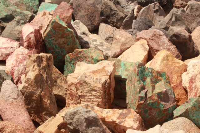
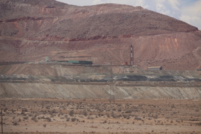
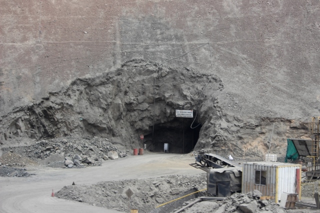
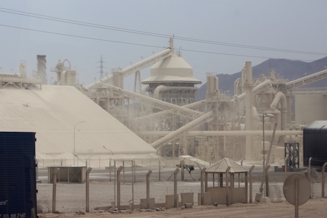
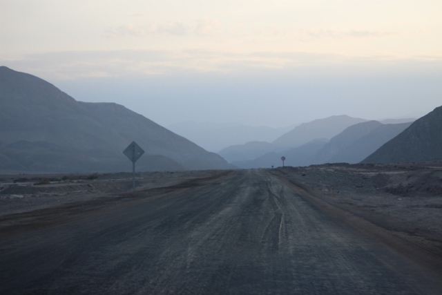
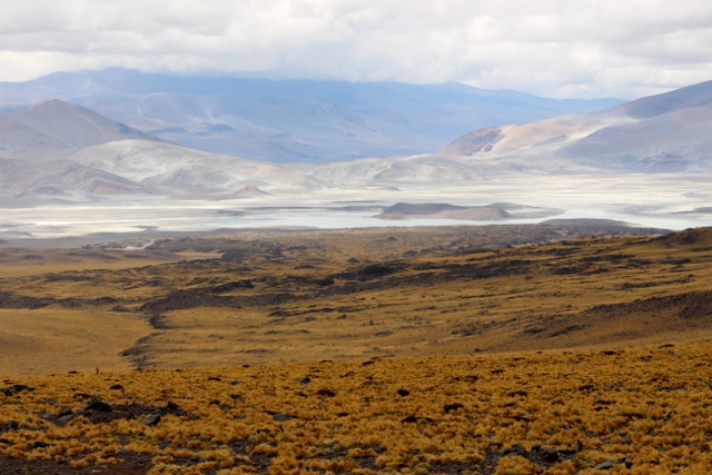
Because of the floodings in Calama we decide to skip going there, skip visiting the biggest open pit mine in the world, the Chuquicamata copper mine. Which has suspended operations anyhow. We also skip a trip inland, to San Pedro de Atacama, an opportunity to get back into the mountains, as many of the attractions here – geysers, salinas – are inaccessible. So we head for Iquique, instead.


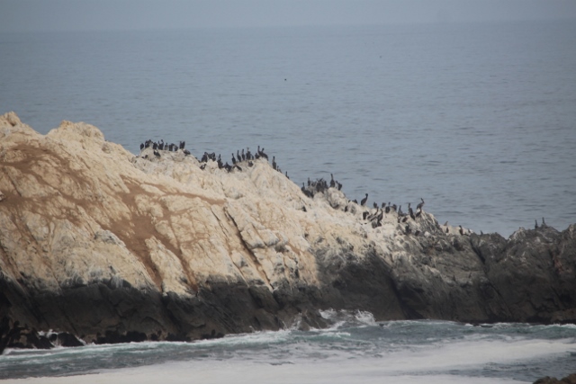
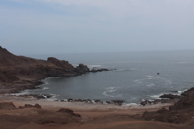
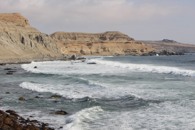
the long coast bewteen Antofagasta and Iquique, with rocky coves

desert meets ocean

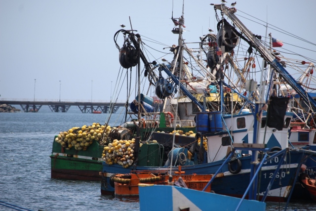
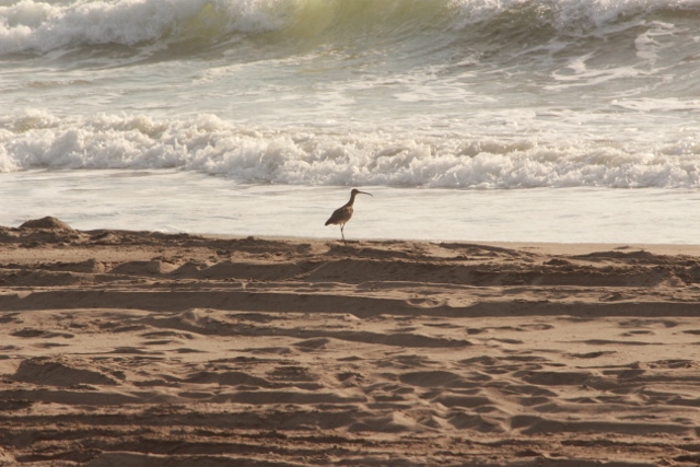
fishing equipment on the beach

and tourist facilities, however basic

the golf course of Tocopilla

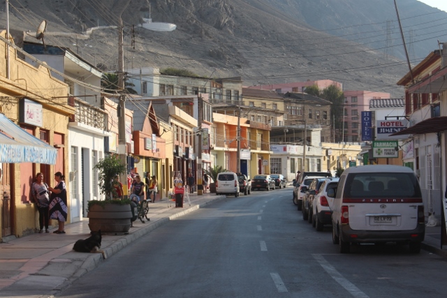
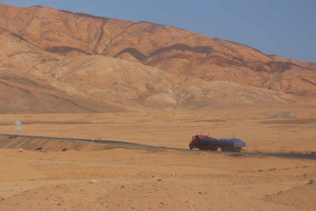
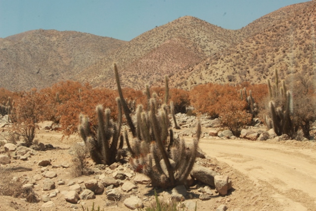
The bus takes the coastal road, which generally is more attractive that the highway through the desert. We are entertained by views of the usual coves and beaches, rocks full of pelicans, and the occasional settlement, which has all the hallmarks of tourist accommodation. To be sure, there is also plenty of glamping Chilean-style along the road – which is quite something, it means that these people have to take everything, food, water, drinks, probably a small generator and a fridge, because the nearest place to do shopping is literally hours away. The only sizable place between Antofagasta and Iquique is Tocopilla, halfway, which stole our hearts because of the golf course the have. Coastal road or not, we are still in the desert remember? No grass, only sand, but softer sand for bunkers, and harder sand for the greens. There are even people playing!

and this one, just outside Iquique

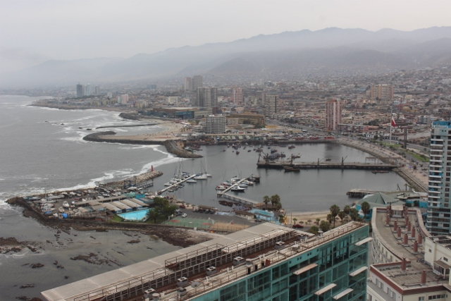
first view of Iquique, from along the coastal road

another view, from along the boulevard

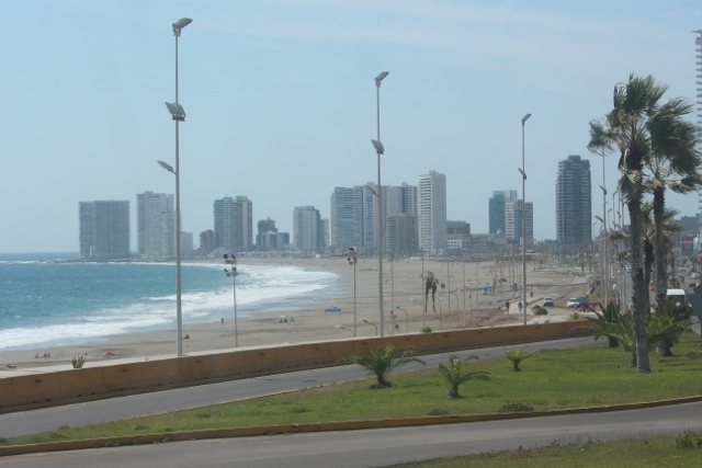
busy beaches, on a weekday afternoon

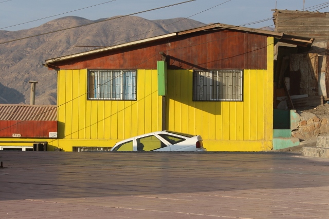
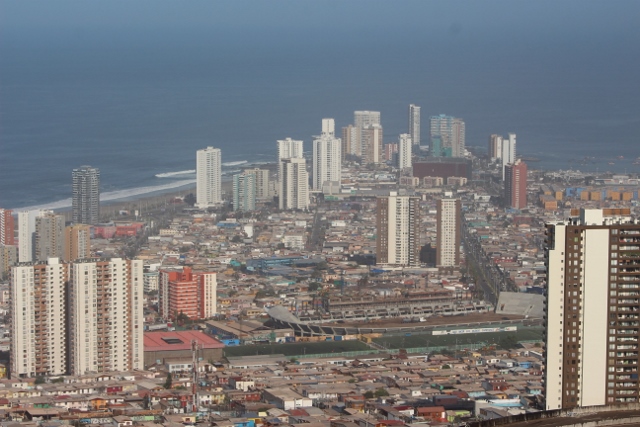
Where Antofagasta was, to be honest, pretty ugly, despite its few ‘pearls’, arrival into Iquique is a whole different experience. We approach from the coastal route, and enter the city along the boulevard, a wide four-lane affair with patches with green grass in between, palm trees, and lined with modern apartment buildings; a well-developed pedestrian zone is alive with many stalls selling food, many people enjoying a walk. It is five in the afternoon on a weekday, yet the beach is quite full. The Peninsula, a stretch pointing seaward, is jam-packed with hotels, fancy apartment buildings, trendy restaurants and bars. Iquique has an altogether more modern look, cosmopolitan even.

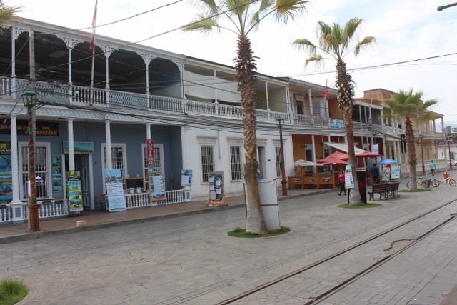
Calle Baquedano, street with old wooden mansions

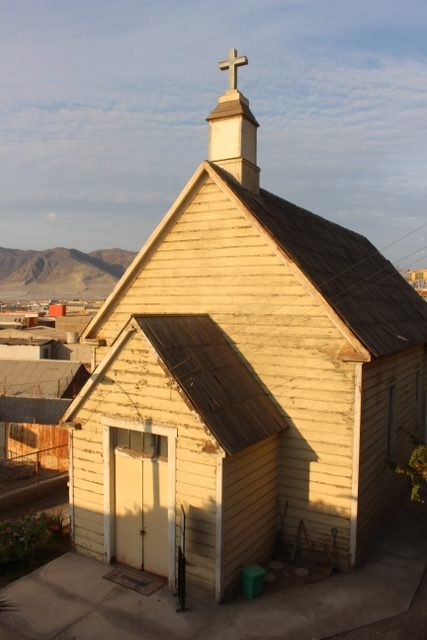
Like anything else in this part of Chile, the town grew to significance thanks to the saltpetre industry, for which is served as a port and trading centre. In fact, it became the saltpetre capital of the country – first Peru, and after the War of the Pacific Chile. And the traces are still there, in the form of a wonderful line of old wooden houses, just one street, built by the mining magnates at the end of the 19th Century. Mansions they were, often two stories high, with elegant galleries and balconies,. Quite a few have been restored, and are being used as restaurant or hotel.

one of the mansions

note the elegant galeries and balconies

and a few more

the old customs building
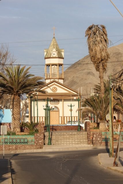
the cathedral tower

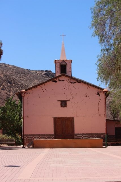
and the cathedral itself

the fishing harbour, drying the sails

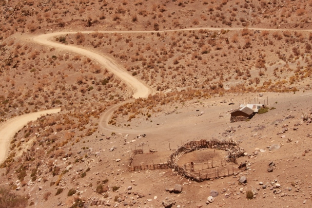
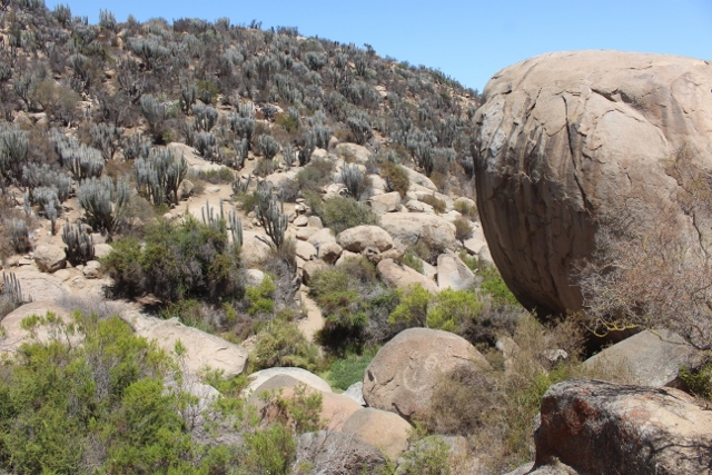
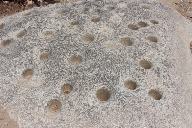
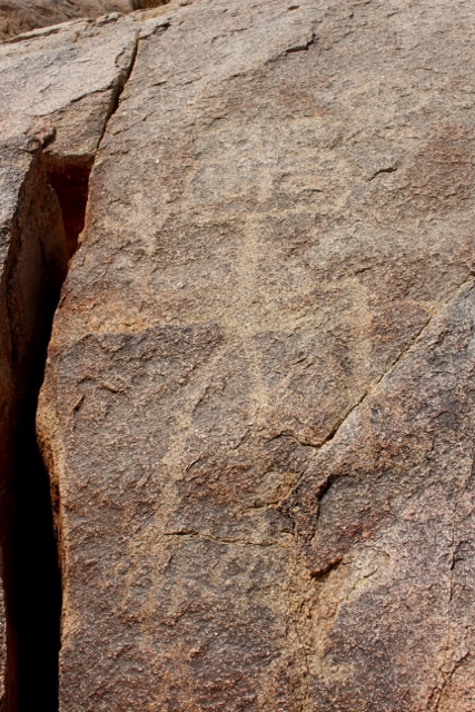
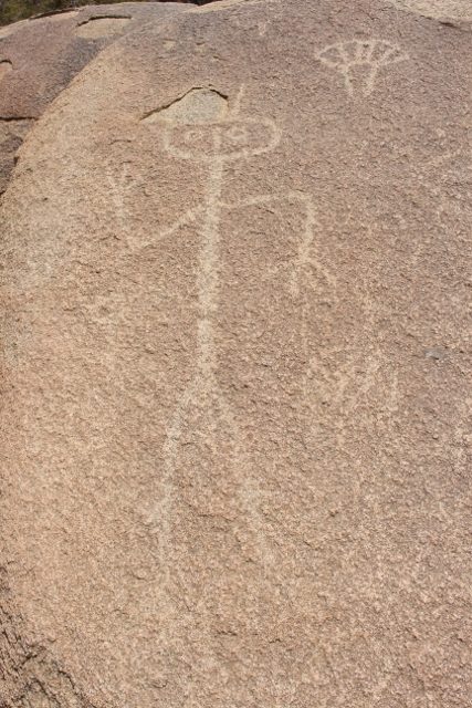
Once again we meet up with family, who live here and receive us very hospitably. They also bring us into contact with a man who knows everything about Iquique, to the point that he even publishes a quarterly magazine, National Geographic-style. We spent a considerable time talking to him, no, listening to him, telling us about the saltpetre history of the region, the intrigues during that era, politically as well as familial – often interwoven. And about the geoglyphs that exist all around in the desert, he seems to know them all. We know what to do, the next couple of days! Which is going to be too short, anyhow.

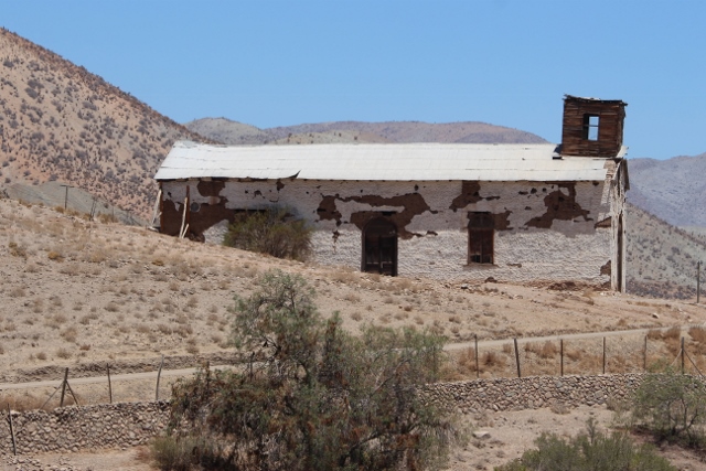
next: the oficinas (the nitrate ghost towns)

looking back onto Iquique, leaving the desert route

not all are huge highrises

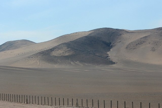
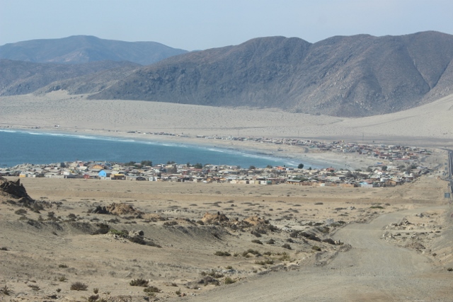
an enormous dune is pitched precariously above the town

and an enormouss dune it is

crane in the port of Antofagasta

Against expectations, the port city of Antofagasta has enough to offer to keep us entertained for a few days.

Known in Chile as ‘La Perla del Norte’, Antofagasta is nevertheless – according to all the guidebooks – an ugly, unattractive port city. One to avoid, really. But we have ignored guide books in the past. This time, because we had arranged to meet up with traveling family.


old steam train in the railway museum

and wagons and the old station, same museum – but closed

at least one train is still driving, through town, from the harbour

the Huanchaca ruins of an old silver factory

one round tower in between many square and rectangular rooms

And sure enough we find our ‘pearls’ in Antofagasta, which, of course, was initially Bolivian, until Chile captured the town in 1879 in the War of the Pacific. The railway station, now a museum, dates from 1873, and was built to connect the town to Bolivia. Nowadays, the only trains that pass through are those from the Chuquicamata copper mine to the port. The silver refinery, now the huge ruins of Huanchaca, somewhat out of the centre, was conceived by the Bolivians, but in the end built under Chilean governance, between 1888 and 1892 – only to stop working again ten years later, because its technology was antiquated and not harnessed against the price instabilities of the silver market.  And in the centre is the clock tower, a miniature replica of the Big Ben in London, donated by the British residents of the town in 1910.

the Plaza de Armas, with church and other old buildings

the British-donated clock tower

with the Chilean-British shield

one of the older buildings, well maintained

some more colour in the streets

old and new buildings go well together

here another one, old mirrored in new

The port, initially developed for the export of salitre in the 19th Century, is actually quite small, and seems to handle mostly containers. A new and larger port has been established to the north, to relief traffic in the already congested city centre. Which must also have been appreciated by the beach goers: Antofagasta has long beaches, and the local population does make extensive use of them on a Saturday afternoon.

All together we enjoyed our time here, not in the least because of the brand-new hotel where we stayed, with 28th floor rooftop terrace and pool, providing beautiful views over this ugly and unattractive city. We even take a day off.

next: Iquique

and the fishing port, from the 28th floor of the hotel

another photo from the top floor down

and up, now not even that far away: the ubiquitous vultures that cruise along all the coast of Chile

part of the salitre processing facilities Santa Laura in the Humberton museum

How the north of Chile, part of which was formerly Peru and Bolivia, has been a matter of boom and bust thanks to its rich variety of commodities.

Before we push into the Ncorte Grande, as the northernmost part of Chile is known, it is perhaps useful to discuss a little history, especially that part that has had such an impact on the north. In his beautifully written “Desert Memories: Journeys Through the Chilean North” Ariel Dorfman, Chilean novelist and poet, remarks on how Chile has been so dependent on commodities in its recent history. We all know about the gold and silver that attracted the Spanish conquistadores, of course, but Chile didn’t have much of that. Lesser known is the nitrate boom of the 19th and early 20th Century, which in fact started in the mid-1800s with the discovery of caliche. The Chilean form of caliche is a hard rock layer several meters below the surface which contains salitre, also called Chilean saltpetre, a mixture of nitrate salts. Nitrate occurs in many more places around the world, but nowhere in such density and such high quantities that it made economic sense to mine it.

some of the mineral rich rocks from Northern Chile, in front of a museum in Antofagasta

rocks in the salar, the areas where the caliche for the salitre was won

What is was used for? In small quantities saltpetre was used in gun power, already a long time back. But when the potential as fertilizer was recognised, boosting agricultural production in California and Western Europe, where farmers were prepared to pay handsomely for the refined white powder, saltpetre became a valuable mining commodity. So valuable, in fact, that three newly independent South American countries went to war over the control of the nitrate fields. In 1879 Bolivia and Chile started hostilities over a disputed mining tax, and Peru was dragged in by treaty with Bolivia, in what became known as the War of the Pacific.

This is not the place to discuss the causes of this war in great detail, but economic reasons were certainly an important part of it. Peru was attempting to establish a monopoly over the nitrate export, and had urged Chile to cut its production, which Chile refused. Bolivia, perhaps, or perhaps not encouraged by Peru, with whom it had signed a secret treaty in 1873, levied a mining tax on Chilean companies, against earlier agreements not to do so for at least 25 years. When Chile refused to pay, Bolivia confiscated the mining properties, to which Chile’s reaction was the occupation of Antofagasta, then a Bolivian port. Long story short, military superior Chile won, occupied large parts of the Atacama desert, and ultimately settled the dispute in 1884. After which both Peruvian and Bolivian territory had ceded to Chile, and Bolivia lost its access to the sea – still a sensitive issue. And from then on Chile controlled the nitrate business.

remains of one of the oficinas, in the middle of nowhere, really

Initially, Oficinas de Compra were established, companies that bought the mined products from independent workers, small-scale miners who won clumps of raw nitrate from the rocks. In 1850s more industrial method was developed, allowing for lower grade caliche to be mined and refined too, further improved in the 1870s by the British chemical engineer Santiago Humberstone. The Oficinas became small towns, company-owned, entirely dedicated to the mining and refining of nitrate. They were largely populated by labourers under contract, who lived in company accommodation, and who got paid not with money, but with tokens, which could only be used in the town’s general store. Coincidentally also owned by the mining company. Or in the theatre, or the cinema, or other entertainment locales. Also owned by the company. Modern serfs. Who ultimately became unintended victims of another war, the First World War, some 40 years later.

In 1910 Chile supplied 65% of the world’s nitrate-based fertiliser. Twenty years later this had dropped to a mere 10%. Because of the war Chilean ships could not reach Germany anymore, and the supply of nitrate came to a halt. The Germans, desperate for fertilizer, found an alternative in the laboratories. And from then on didn’t have any need for Chilean nitrate anymore. After the war they marketed their new discovery, which was cheaper, cleaner, easier.

Not all the nitrate business stopped immediately, but the boom was over. Many of the Oficinas are now ghost towns, nobody living there anymore, most of the buildings derelict, or gone altogether. At the end of the 20th Century there were only two working nitrate towns left,  Maria Elena and Pedro de Valdivia, both a couple of hours north of Antofagasta. However, their methods of extraction were developed only in the 1930s, and are more modern then the original hard labour required to mine the white gold of earlier. And further north, originally opened as the Peruvian Oficina La Palma in 1862, is Humberstone, which was reopened in 1932, and renamed after the British engineer. Humberstone is the perfect ghost town, everything – shops, theatre, houses – still largely intact. Together with nearby Santa Laura, where the production facilities are located, this has been dedicated as a museum to the nitrate business. So important for the development of independent Chile, and now almost forgotten.

modern day mining is everywhere in the Atacama desert

and export of mining products occurs along the entire north coast

one of the products ready to be shipped, in the port of Antofagasta

Luckily, the world that didn’t need nitrate anymore, did need copper. And luckily, Chile also has vast amounts of this mineral in its territory. To the extent that at the beginning of the 21st Century Chile supplied some 60% of the world’s copper. Much of it derived from the world’s largest open pit copper mine Chuquicamata, located somewhere between Maria Elena and Pedro de Valdivia, and close to Calama. Northern Chile’s commodities remain a very important element in the country’s economic workings!

next: Antofagasta

and to add a bit of colour: an unusual appearance, this looks a horizontal rainbow – nothing to do with the story, of course, except the location, the Atacama


the lighthouse of Chanaral

Our travel northwards into the Atacama leads not only through desert landscpae, but also along the coast, with a pleasant overnight stop in Chanaral.

Having returned our rented car in La Serena, it is time for the real push north. But we may have a problem. Not a problem as big as that of the poor people directly affected, who have lost houses, crops, and even a few lives. The north of Chile is experiencing extreme weather, it even rained in the what is supposed to be the driest place on earth, the Atacama desert. Worse, in the mountains it has been raining incessantly, which has caused flash floods near Calama and Arica. The floods have washed away bridges, and made roads unpassable, especially higher up in the mountains, like the area around San Pedro the Atacama and the National Parks above Iquique and Arica. All places we intend to go to, but we may have to reconsider. The main motorway, and only connection, between Iquique and Arica has been closed for days now, and with continuing rain is unlikely to be repaired soon.

desert landscape on the way to Chanaral

and desert meeting sea

along one of the many bays, the small village of Puerto Flamenco

the main street in Chanaral

the main church, in the plaza de armas

and a cute little wooden church slightly higher up

Anyhow, it is still a while before we get there, we still have some distance to cover. From La Serena to Arica is well over 1500 km. Of desert. Our first stretch takes us to Chanaral – not the village from where we viewed the dolphins, but the capital city to a region further north. Well, ‘capital city’ is perhaps creating too much expectation. Chanaral is a really small town, with a bus station, a hotel and a restaurant, which is all we need to overnight. And yet, an evening stroll through town, part low-lying around the bay and the beach, and in places steeply built against the mountain, yield yet another lovely little church, some colourful streets, and a peculiar light house towering above the town.

some of the streets are pretty steep, in Chanaral

more desert, north of Chanaral

vulture resting

pelicans on the rocks

the coast near Taltal, on the way to Antofagasta

glamping, lots of families together

and they bring everything under the black tarpaulin

On the way to Chanaral: desert on the right, and a lovely coast on the left, with rocky bays and the occasional fishing village. And on the way from Chanaral: desert, on both sides of the motorway, until the bus turns to Taltal, on the coast, for another ride along the ocean. A lot of glamping Chilean-style, and an incredible amount of pelicans, mounted on their conspicuously white rocks. Ah, and mining, along the coast and in the desert; everywhere there is mining in Chile.

next: an intermezzo on Chile’s commodities.

and then there is mining, small scale

and much bigger scale operations, near Antofagasta

and where mines are, are the trains

blooming cactus on the way to Hurtado and Ovalle

A beautiful drive through the mountains and the Hurtado Valley, covered with blooming cacti, an interesting Valle del Encanto with petroglyphs, and disappointing Ovalle

The road to Ovalle, or at least the one we choose, leads through the Hurtado Valley, starkly contrasting with the earlier Elqui Valley. No lovely little villages here, no soft-green plantations. A rough road – suddenly we are quite happy with our 4WD camionetta – leads up several valleys, across a few low passes, into what ultimately becomes the valley of the Rio Hurtado. Initially there still some grapes around, but soon we lose all of the vegetation… except for the cacti! Many of which are adorned with big bunches of bright red flowers. Others are faintly yellow, or carry fruits. I love these cacti, in the wild, and this collection, kilometre after kilometre, is a truly fabulous sight.

the vegetation, low scrub, and cacti as far as the eye can see

bare mountains in the distance, cacti in front

and how about this for flowers?


another cactus, with yellow fruits at the top

or, like this one, yellow and red

a fruit hidden behind the spines

an other type of plant, also looks cactus

and this tree-like thing, whatever it is

in the almost colourless desert, a bright signpost

this is indicating a very steep slope indeed!

this is a bigger observatory, it looks

absolute nothingness – except for the observatories

a completely isolated farm

Very occasionally, we see signs of life. More observatories on the top of the hills, a forgotten farm, or a direction to a distant hacienda. But mostly, all around us nature, no signs of life. It is not until the village of Hurtado, a sleepy place of some 400 inhabitants, that we feel that we are back in the world again. Not in the least because the charming little churches we know from the Elqui Valley start appearing, too.

the main church of Hurtado

inside needs a bit of work

another church, unused now; I think it is called Seron

front view of the same church

and this one, too, is in the valley, and may be called Samo Alto

Our luck hasn’t been restored entirely, yet. Arriving in Ovalle, we find that we have a flat tire. And it is Sunday, the day that all the restaurants are closed in the evening. The next day, the museum, for which we came here, is closed – every Monday every museum is closed. The other attraction in town, the much heralded Feria Modelo, an iron market said to be the biggest fresh produce market in northern Chile, is a big disappointment, too. The building is from 1986, not very old at all, and the market itself is not very busy, and quite well organised, and thus has no atmosphere to talk about, let alone it being photogenic.

the rocks in the Valle del Encanto

some of which have lots of holes, perhaps even in patterns

but we came for the petroglyphs

some less clearly visible, but nice enough

others deeply carved in the rock

this is part of a larger frame

We decide to leave Ovalle, and treat ourselves to a stay in the Hotel Thermas de Socos, in a village a little further. On the way, we stop the small Valle del Encanto, where a collection of ancient petroglyphs has been found. We scramble over several rock outcrops, and indeed find a number of, well-signposted, petroglyphs, mostly geometric forms and stylilised human heads. Quite different from the guanacos of the hippie establishment earlier, these are firmly assigned to the El Molle culture, an indigenous society who lived in the area around 500 – 700 AD – altogether no so very old, I think, compared to other petroglyphs in the world. A noisy guide tries to convince me that the holes we see in several of the rocks were used to grind maize, but also for star-gazing and producing halogenic substances. Hippie culture, after all? More disturbing are the few other visitors to the site, either with screaming and nagging children, or with a loudly music-playing telephone to accompany their walk. Welcome to nature, anybody?

How contrasting then is the thermal spa, the Hotel Thermas de Socos. We are two of seven guests in total, we have the pool for ourselves, and the signs warning everybody to respect silence between 14:00 and 16:00, the time for siesta, are unnecessary today.

next: heading further north to Chanaral

which shows the scale of things

a small telescope in the observatory – to be fair, we looked through a bigger one

Under the brightest sky of the world, you do have to have visited an observatory. Or do you?

Vicuna is also the self-declared astronomy capital of the world. Thanks to the altitude and generally clear skies, there are no fewer than thirteen observatories in the area. A few big, professional ones can be visited for its facilities, during day time, but, really, you want to be there at night, to see some of that twinkling mystery yourself, through a real telescope. Which is where the commercial observatories come in: buy yourself a half-decent telescope, install it, preferably, on a hill, or at least in a place away from too much light, start organising tours twice a night, and there you have your business model.

Just outside Vicuna is Mamalluca, an observatory ran by the municipality, but we were advised that visits here are really a massive affair, with groups of 80-90 people. Instead, we went to Alfa Andea, a small outfit – they are all small outfits – recommended to us by the owner of our hotel. To be fair, we had no other recommendations. We were picked up at 11 pm, by the owner of the observatory himself – who turned out to be a friend of the owner of our hotel.

one of the other tourists, looking through a pair of 3D glasses

Our tour started at 11:30. First we were herded into a small white cupula, where we received a brief introduction about astronomy; much too short, but you cannot expect to be explained such complex subjects in a couple of minutes, in both Spanish and English, it invariably reduces to some platitudes like “whatever we see has happened in the past”. Followed by a 30 minute film of a journey back through the universe to the Big Bang himself, which had elements of Star Wars and Planet of the Apes in it, flying rocks and collisions and the lot. Then we listen to Jupiter and to the sun – because we also have been explained that we see only a small part of the spectrum, much of it falls outside the visible part, but luckily some of it is audible. Right. Jupiter sounds like some experimental Russian classical music, the sun more like the low humming noise of a large speaker box at full volume without music.

After an hour or so, we are ready for the real thing, and walk through the dark to an amphitheatre where the telescope is. The sky is indeed incredibly clear, and our guide has no trouble finding several well-known constellations and pointing them out to us. And then he directs the telescope at some point of interest, a galaxy, a nebula or some other phenomenon, and one by one we get to take a look through the lens. To see even more than we see with our bare eyes (and me with my glasses on, which already improves the view significantly). OK. I suppose some people find this exciting, but I don’t.

Because we are a small group, this process repeats itself no less than five times, five different points of interest. It is getting cold. I am getting bored. By half past one we are done, and we are brought back to our hotel again. I suppose you have to have done this, whilst you are in the astronomy capital of the world, but once is enough.

next: Ovalle and the Hurtado Valley

the cupola where we received our introduction, and a glass of wine

the Torre Bauer in Vicuna

Convenient and pleasant Vicuna is a good base for an excursion into the rather hippy-esque, grape-growing Elqui Valley and its pisco distilleries.

the interior of the church in Vicuna has beautiful wooden pillars

the locals on the main square have so their own view on the tourists

An hour land inward from La Serena is Vicuna, a convenient base to the Elqui Valley, known as one of Northern Chile’s touristic highlights. More about the valley later. Vicuna is a small town, standard lay-out, except that the Plaza de Armas has been renamed Plaza Gabriella Mistral, in honour of the Nobel laureate poet born in the area. The most eye-catching building is a red wooden fake-medieval tower, Torre Bauer, in one corner of the Plaza, prefabricated in Germany and shipped and erected in Vicuna in 1905 to the mere glory of the German-born mayor of the same name. And that is really everything there is to say about Vicuna, except that it is a very pleasant, quiet town, home to our excellent guesthouse for a few days. Oh, and the observatories, but that warrants a separate entry.

extensive grapes outside Vicuna

the grapes are dropped in the sun to dry

and four days later packed in bags as raisins

this in the vine yard of a pisco distillery

moscatel grapes in the shade

ripe to be harvested

the distillery column – this is the one they use – is in the two metal cylinders

A little east of town (and perhaps west, as well, but it was dark when we arrived last night) start the extensive grape vines which give this area its fame. “Oh no”, I hear you thinking, “not more wineries!”. Well, the first grapes we pass are in fact for eating, not drinking. Or more specifically, for raisins. The ripe bunches are dropped on a piece of waste land, spread out in lines, and dried in the sun. Four days later, grapes have turned into raisins, it is that easy. Well, a bit of cleaning and packaging, details really, but the sun and the dry air do most of the work.

But not all of the grapes are wasted onto raisins. The vast majority is actually used for the production of pisco, the main ingredient for pisco sour, Chile’s (and Peru’s) national drink. There are quite a few distilleries around Vicuna and in the valley, some industrial-size, and some artisanal – which means small-scale, big price. We leave the industrial-size for some other time, and visit two of the small-scale ones, Los Nichos and Dona Josefa, outside the village of Pisco Elqui. Until 1939 Pisco Elqui was called La Union, but to counter Peru’s claim to exclusivity of the drink’s name, based on a town called Pisco in Peru, Chile renamed the village and created its own claim. Production of pisco turns out to be pretty simple, really. Let the grapes ferment for a couple of weeks and distil the resulting wine, leave in oak barrels for a while, add water and put in a bottle. Dona Josefa produces 80,000 bottles a year, and sells all of them directly to tourists who come to visit, and buy.

the tourist map, painted on a tile against the church wall – this sums it up

the Elqui valley

Pisco Elqui is in the Elqui Valley, further east. The valley is extensively cultivated, with various fruit trees, but mostly grapes, which produces a lovely view all along, the radiant green of the grape vines at the valley bottom and a little up the slopes, and the rest just bare, dry rock, with no vegetation whatsoever, except the occasional cactus. Along the valley, small villages like Pisco Elqui provide a low key backpacker tourist environment, immediately reminiscent of Villa de Las Rosas (see the earlier entry on The Sierras, in Argentina). Lots of handycrafts, lots of locally made food, sold on the plazas in front of the small wooden churches. Free-wheeling, aimlessly wandering people. Guitars, singing of folk songs. The distinct smell of marijuana. Hippie-esque, I called that earlier.

mostly grapes on the valley floor, and on the lower ranges

the Piedra de los Guanacos

in the magnetic centre of the earth, through which flows the magic river

the guanacos in a bit more detail, the top ledt of the rock

and this shows the scratching technique used

In a little side valley, that of the Cochiguaz River, there is even a real hippie commune, founded in the 1960s by a group of then young people who were convinced that in the Age of Aquarius the magnetic centre of the earth had shifted from the Himalaya to the Elqui Valley. Really. They renamed the river the Rio Magico and the valley the Valle Mistico. Really. I am sure your Spanish is good enough for this. To our surprise we also came across a large rock with petroglyphs, full of images of guanacos, an indigenous lama-type animal. The images are pretty basic, and I wouldn’t have been surprised if they actually date from the establishment of the commune, but apparently they are really old. And thus serve as spiritual anchor for the commune – on the internet I came across pictures of mass worshipping and the like, but we didn’t see anybody else ourselves.

this is the Mystic Valley of the Magic River

On the way back we finally found some place where they do the right things with grapes. A winery, indeed. Caves de Valle, at 1800 meters claimed to be the highest in Chile, was established some 25 years ago by a geologist, who decided on a career change – where have I heard that before? –  and has been making wine ever since. Of quite acceptable quality, to the effect that we even bought a bottle, a rare Malbec in Chile, which we consumed the same evening. End good, all good.

But there is more to come on Vicuna…

next: the observatory

and there is even some bird life

sea lion on the rocks of Isla Chanaral, an island in the National Park

A day full of wildlife on the island of Chanaral, part of the National Reserve Pinguino de Humboldt.

Because we had to abort our plan to loop across the Andes back to La Serena, we now have to backtrack, to return our rented car. It is prohibitively expensive in Chile to drop off the car in another place than where you have rented it. And in any case, we still have some unfinished business there.

curious guanaco

two curious guanacos

on the way to the National Park

anouncing the metropolis of Caleta Chanaral de Aceitunas

imposing rocks of Isla Chanaral

and equally impressive breaking surf

What we hadn’t realised, is that it is whale season along the Chilean coast. And one of the best places to see them is in Caleta Chanaral de Aceitunas, a whole mouth full for a tiny little coastal village between Copiapo and La Serena. We thought, naively, that if we would go there, we would see whales – you know, just see them jump up and down from a comfortable location on the beach -, but no, you need to take a tour in a small boat to the island of Chanaral, which is in the National Reserve Pinguino de Humboldt, populated by a few scientists, and furthermore by thousands of sea lions and Humboldt penguins. And you may, perhaps, see dolphins and whales on the way.

As it happened, our usual luck seems to have returned. Arriving in the village, we were just the two people who would make up the quorum to start the boat tour. So we left within five minutes – where others had been waiting for over two hours.

the island in the sun

the so-called bachelor’s rock, with hundreds of sea lions

one of them in more detail, snoozing

Humboldt penguins

on their way to God knows what

and in a meeting…. funny little animals!

pelicans, not for the first time

and cormorants, note the conspiciously white rock

these are the Peruvian Booby

also funny birds

and this is the very rare one from the Galapagos – I told you, swift and far away

The sea was still pretty rough, with big waves coming our way, and breaking on the rocks of the island, which we reached after some 20 minutes. And sure enough, plenty of sea lions, and plenty of penguins. And pelicans and cormorants, and something called Peruvian Booby, and even a few, apparently very rare, birds almost entirely limited to the Galapagos Islands – of which I didn’t get the name. They are far away, I can’t see much, and a chance photograph isn’t very sharp, but there you are.

At the end of the trip we even spot a group of dolphins, who obligingly jump a few times. Great excitement in the boat, because they had been eluding us so far.

But the whales for which we actually came? No, they kept eluding us all together.

next: Vicuna and the Elqui Valley

and finally the dolphins

going down

after having gone up, of course

end of a joyful day

one of the old graves at the Lego Cemetario in Caldera, near Copiapo

Instead of small-town Copiapo, we check out the cemetry of Caldera and the beaches in the neighbourhood, which don’t disappoint.

wedding cake-like church tower of Copiapo

Back from our failed border crossing attempt we establish ourselves in Copiapo, quintessentially small town Chile: mostly low, single story houses in centre, not particularly attractive, but quite atmospheric. Our luck hasn’t restored itself yet. On top of permit problems of yesterday the car also has developed a problem, so we contact the rental agency, waist another morning, and finally get a new car. The only one available is a camionetta, a pick-up truck like the ones we have seen the miners use in the previous days. But who cares?


the fishing harbour of Caldera

with slightly larger vessels than we have seen so far

some of the old graves in the cemetry of Caldera

a half-rotten wooden frame around an old grave

another wooden one, just slightly better kept

a half-gone wooden cross

and the tomb of John Mackensey, suspected vampier

We drive to Caldera, a small fishing port an hour away from Copiapo, with bigger ships than we have seen so far, and with a small beach. Caldera has achieved fame for its Lego Cemetery, which was the first cemetery in Chile to allow people from different denominations – read: Brits and Germans, who were not Roman Catholics – to be buried, too. The cemetery, from 1876, is still being used; between the modern graves are the old ones, framed by rusted iron fences, or rotting wooden ones, with half-collapsed crosses and barely readable inscriptions. Many are overgrown, with the plants planted well over a 100 years ago, and no descendants to take care of the graves anymore. Yet, the caretaker explains that they leave the graves as they are, why not, respect the deaths. One is particularly interesting, a large wooden tomb in the corner, no name, but apparently the grave of John Mackensey, according to legend the late 19th Century vampire of Caldera, who was killed by the town’s inhabitants – but in reality was nothing more than a bohemian Brit with bloody gums.

oyster catchers on the beach

the beach at Bahia Ingles

compared to that of Las Machas, opposite

Along the coastal road south is Bahia Ingles, named after the English, who played such a big role in Chilean coastal history, as pirates and as supporting the navy, and later on as investors, in the mines and the railways, and as traders. This is the most photographed beach in Chile, famed for its clear and turquoise waters. It is pretty windy today, the sea is a little rough, and we don’t spot the special colours, only those of the parasols on the beach, which is, unlike any other beach we have seen so far, packed with holiday makers. Just a little further, within view of the Bahia Ingles beach, there is almost nobody anymore, at Playa Las Machas. Also zero facilities, of course, but even at the most popular beaches in Chile there are not many facilities, Chileans bring everything themselves. We dip our feet once more in the Pacific.

concrete fossils in the Parque Paleontologia

but the views from the park are nice

Quite unexpectedly we come across the Siteo Paleontologia Los Dedos, a palaeontological park. This has to be explored, of course. A very enthusiastic caretaker – a reason in itself to visit this place! – walks us to the first location, where we get to look at large-scale fossils in situ, in the place where they have been found. Except that the real fossils have been taken to the museum and have been replaced by concrete replicas. Hmmm. Still, there are plenty of bone pieces to admire, and great views.

another bay, little further along the coast

and a rocky strech, crashing waves

Thanks to our camionetta we can get to more beaches, further off the road, but not all are equally nice. Some have been used as drinking and 4WD joy-riding places for local youth, evidenced by mutliple tracks in the sand and empty beer cans. And dipping our feet becomes less attractive when we encounter lots of giant jelly fish stranded on the beach.

no feet in the Pacific, this time…

glamping Chilean-style

the houses of Puerto Viejo

Some places along the road have been developed, with what I call glamping Chilean-style. Big black tents have been erected, on or near the beaches, and it seems that tourists put their own tents, and sometimes their caravans, under these tents. For privacy? Because it is cooler? Beats me.

At the end of the road is Puerto Viejo, which means old port. But there is not much of a port here, really, and only a small beach. It is a strange village, with a strange atmosphere. It looks poor, yet each ramshackle wooden house is fenced off, with chicken wire or corrugated iron; many seem to have been boarded up. Not a place to stay, as far as we are concerned. We get back to Copiapo.

next: wildlife spotting at the island

and a lone occupant of yet another beach

some rare vegetation in a valley towards the Paso San Francisco

Despite a set-back, we drive up the increasingly scenic Paso San Francisco, on the way to Argentina, only to experience the next set-back.

Our luck seems to be running out. We will have to shelf the idea of crossing the Pircas Negras Pass – a pass which is only open in (Southern Hemisphere) summer -, because of bad weather. In summer!

But there is another pass, Paso San Francisco, a little further north. It means a longer drive on the Argentinian side to return to La Serena, but at least we can complete the idea of a clockwise loop. And this pass is open, according to the carabineros, who add that we need to be at the border by one o’clock latest, afterwards they don’t let anybody through anymore. The two border controls, Chilean and Argentinian, are about one-and-a-half hour’s drive apart, one on each side of the pass.

the early morning , monotonous road, monotonous colours

the mining activities don’t add much to the colours

We leave early, with the jerry can, water and food within reach, just in case! The weather is lousy, it is overcast, and for the first hours everything is grey. The road, unsurfaced, follows the valley of the Copiapo River, which is straight, and boring. Yet, we are gradually climbing: popping ears. Every few kilometres there is another turn off, to another mine, and the only traffic is mine-related, sturdy pick-up trucks that put our small sedan to shame.

until the sun breaks through…

and everything looks a lot brighter, suddenly

colours of rock become distinguishable

the shape of a volcano, perhaps?

a curious fox hopes to get fed

salt and suphur deposits

being won commercially, it seems

It is only when the sun comes out that we start appreciating the landscape. Still no vegetation to speak off, except in the occasional valley which supports a little water. But the rocks are taking on their true colours, red, green, yellow, grey and black. There are Salinas, extensive salt flats, there is Laguna Verde, a high altitude lake on the Chilean side, there are flamingos, even foxes. Past the Chilean customs post, which we clear in no time, we enter the area of the true mountains, the higher peaks, snow covered. Amongst them, the highest active volcano in the world, 6893 m Ojos de Salado – cloud covered, unfortunately. But spectacular landscape we have, and it takes us much more than one-and-a-half hours to reach the Argentina customs. Through which we expect to breeze through, as well.

we are getting higher, obviously

the first snowy tops, above the salt flats

same salt flats

snow, desert and greens in one view

one of the snow covered mountains on the way

and another one

Laguna Verde, in between customs posts

complete with flamigos

in close up

ready to take off

near the Argentine customs office, guanacos

Hmm, not so quick. Although we do have an International Permit from the rental agency, the Argentine computer system doesn’t recognise the permit number. Whether that means that the car is not properly registered for international crossing, or whether the Argentine internet connection has broken down just now, so that their system wouldn’t have recognised any car at all, we will never know. That they could, in the past, in such a situation manually enter the permit in the system, but that from 2019 onwards they are not allowed to do this anymore, doesn’t help either. Long story short, we can not cross the border with our car. We have to go back to Copiapo.

Our luck seems to be running out.

at the foot of the cloud covered Ojos de Salado

and another view of the mountains