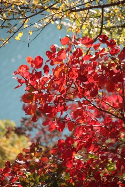
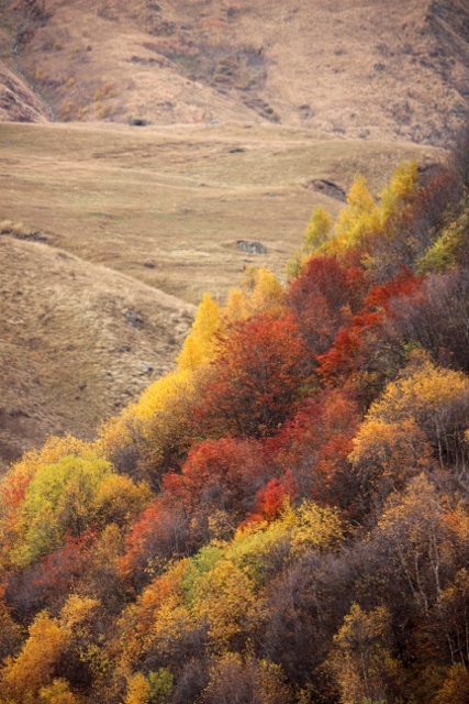
spectacular autumn colours along the Georgian Military Highway
One of the most accessible roads into the Caucasus is the Georgian Military Highway, which continues into Russia, with several touristic attractions along the way, both man-made and natural.
The Georgian Military Highway – what’s in a name? – has been a trading artery since antiquity, allowing goods to be transported between Georgia and Russia across the Caucasus. It connects Tbilisi with the nearest Russian town of importance, Vladikavkaz. The military component in the name is mostly derived from Russian troops, who used the road for the first time at the end of the 18th Century, when Russia began to covet its Transcaucasian neighbours. It was also the Russian army who transformed the mountain track into a proper road in the 19th Century, at a for that time staggering financial expense.

the Zhinvali Reservoir

the two churches at Ananauri, from above

entrance to one of them

the outside decorations are quite something
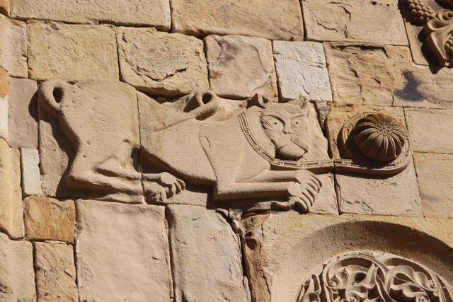
detail of one of them, more pagan than Christian, perhaps

frescos on the pilars inside one of the churches

Saint George on a horse
We start from the village of Natakhtari, where we had found a small hotel after the wine tasting experience of the day before. As so often, the concept of Highway needs clarification, we are talking about a two-lane road here. But the road is in good condition, no potholes, no parts that are about to disappear in the abyss. And it is busy, lots of trucks on their way to and from Russia. And lots of tourists, too: this is one of Georgia’s top attractions, and easy to reach.
The first villages we pass are mostly noteworthy because of their picturesque names, like Miesaktsili, Tsitelsopeli, Bulachauri, or Aragvispiri. At Ananauri we, together with hundreds of others, stop for the famous churches here. There are two, crammed right next to each other, which is a pity, because several of the exquisitely carved decorations on the outside walls are now hidden from sight. In one of the churches some frescos remain, one depicting the underworld in graphic detail – reminiscent of what we have seen in the wooden churches of Maramures, in Romania, some years ago. The setting of the churches, at the end of the Zhinvali Reservoir that feeds Georgia’s foremost hydro-electric plant, is beautiful, especially seen from one of the several stone towers that surround the walled complex.

the underworld, complete with torture and devils
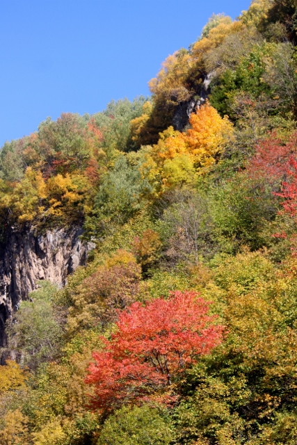
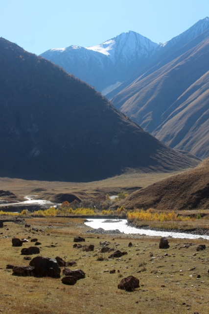
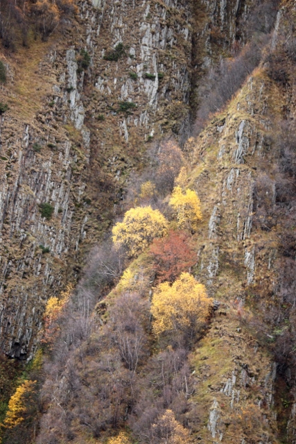
autumn colours in the mountains
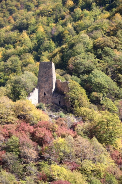
a watch tower, one of many along the Highway

the Caucasian mountains in the back

and a gorge in the fore ground
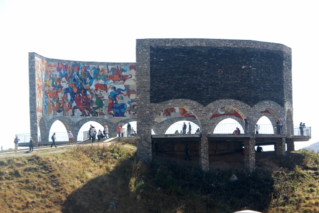
the Russian-Georgian Friendship Monument, of long ago

honey sales along the way
From here we follow the road along the Agrevi River, mildly climbing until we reach a series of long drawn-out hairpins that bring us to a high plateau, and to Gudauri, Georgia’s number one ski resort. It is a mess, a total lack of planning has led to the completely unregulated development of hotels and apartments – and still ongoing, there is enough money around for yet more winter sport resorts. In between, chairlifts and gondolas make their way up the slopes: I hate to think what this looks like in season. Gudauri is at 2000 meters, the highest settlement in along the Military Highway, but the road itself climbs further, past a monstrous monument to Georgian-Russian peace – from 1983, a time well before today’s state of war, thanks to the two small Georgian break-away republics South Ossetia and Abkhazia – to the 2395 m Jvaris Pass. Under normal circumstances this is already a beautiful piece of road, with views across the high peaks of the Caucasus, but in autumn the dramatic colours of the trees add something extra to the views.
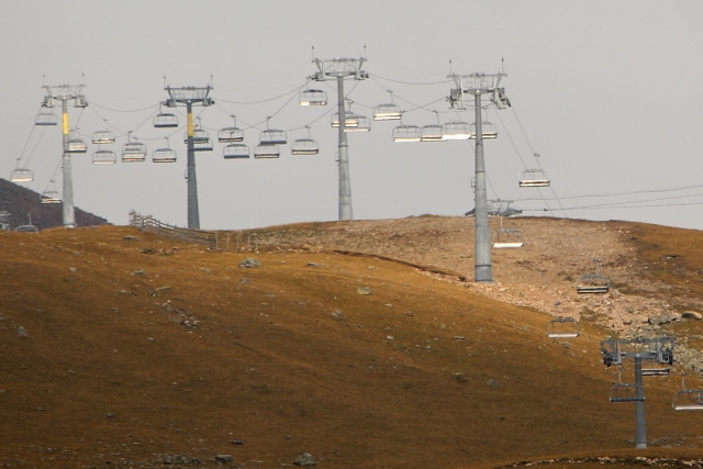
ski lifts in Gudauri
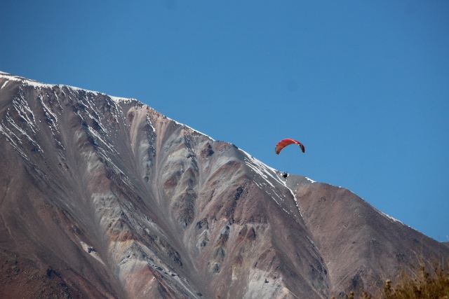
paragliding country, but like nowhere else

the Truso Gorge, water coming from below the basalt
at the far end of the gorge, the Tergi river valley

distant snowy peaks

village at the foot of the mountain

hay having been harvested

the basalt organ pipes

as backdrop to a single house, late afternoon
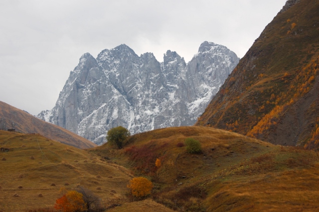
Down, north from the pass, we decide to take a small track off the main road, into a valley, leading up to the Truso Gorge. Here we have the views, including the autumn, but without the traffic. Well, without the highway traffic, but with plenty of hikers, who walk up and down the narrow road past the gorge. And are no doubt thrilled by us slowly negotiating the road by car. A series of basalt organ pipes provide the backdrop to scattered villages, isolated houses and old watch towers, along the valley and high in the hills. Fabulous scenery.
the Sioni church and watch tower
Back on the main road we continue to what is officially called Stepandsminda, but generally referred to by the name Kazbegi, after a local poet who also gave his name to the majestic Mount Kazbeg, with well over 5000 m towering high above the rest of the mountain range here. There is little to do in Kazbegi except sleeping and eating. In a small village higher up is the Gergeti Holy Trinity Church; this is, at 2170 m and silhouetted against Mount Kazbeg, another one of those Georgian churches in imposing locations. It is centrally placed in the popular hiking area around Kazbegi, but since the tarmac has reached the church, in 2018, more people visit by car or tourist bus than come walking. And so did we, as the weather has changed for the worse, overcast with occasional rain where the day before it had been a spectacularly clear blue sky.

Mount Kazbeg, late afternoon
the Gergeti Trinity Church

with one of the carvings outside

the bell at the Gergeti Church
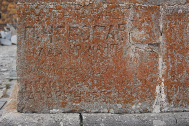
Russian graffiti from 1889, outside Gergeti Church

the view over Mount Kazbeg, from the Gergeti Church
more autumn colours, Sno Valley
autumn colours, Sno Valley
a rocky massif at the end of the Sno Valley
sculptures of local poets in the Sno Valley

Sno Castle, a slightly more elaborate watch tower

a typical house in the Sno Valley

and another one, with lovely verandah
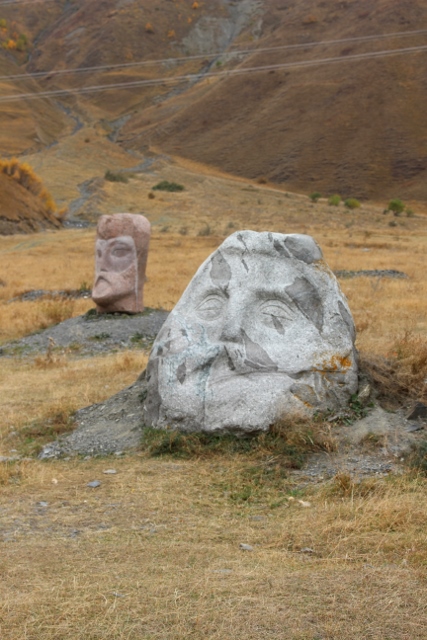
On the way back – back down the Military Highway – we detour briefly into the Sno Valley, another one of these lovely wooded valleys bathing in autumn colours. But, given the weather today, it cannot compare with our experience the day before in the Truso Gorge, even though the Sno Valley sports the ruins of a small castle cum watch tower, and a rather unusual sculpture garden, with the carved stone heads of local artists placed seemingly at random in a field along the road.
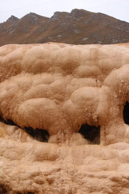
travertine depositis at a mineral spring along the Georgian Military Highway

stuck behind the sheep
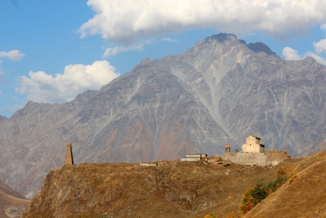
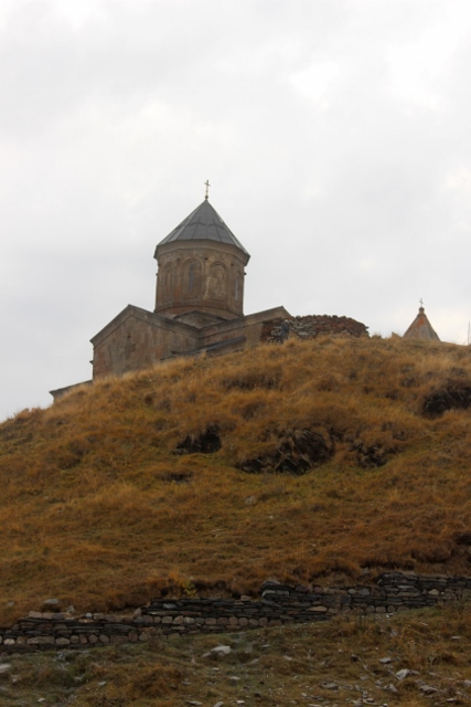
Only much lower, and towards the evening, the sun breaks through again. By now we have left the Military Highway, on our way to another Caucasus valley further east, Tusheti. We get stuck behind a group of sheep, for the first time but not the last, as we will find out in the next couple of days. And on a whim we follow a sign up a hill to a ruined fortress and a small church, which turns out to be the absolutely lovely Kvetera Church. Much nicer than many of the churches we have seen so far, and the best is, there is nobody else, we have the place for ourselves. Not every part of Georgia is so touristic.
next: to wild and exciting Tusheti.

the ruined Kvetera castle

and the Kvetera Church compound

with the church itself, all for ourselves


